Snowdon Range

Snowdon Range
Snowdon Range from Moelwyn Mawr

Friday, 22 May 2020

CAMINO FRANCES

CAMINO DE SANTIAGO - CAMINO FRANCES


For details of this long distance path and how it was completed search on "Ricardoscamino" in Youtube.

RICARDOS TALLY OF LONG DISTANCE PATHS SO FAR


LONG DISTANCE PATHS COMPLETED AS AT 22 MAY 2020


1066 Country Walk (East Sussex)

Allan King Way (Hampshire)
Angles Way and Angles Way Link (Norfolk / Suffolk)

Anglesey Coast Path (Wales)

Avon Valley Path (Hampshire and Wiltshire)

Balcon de Cote D'Azur (France)

Beacons Way (Wales)

Blackwater Valley Path (Hampshire)

Brenda Parker Way (Hampshire)

Camino Frances (Camino de Santiago – France and Spain)

Castleman Trail (Hampshire / Dorset)
Chemin du Mont St Michel from Cherbourg (Normandy)

Clarendon Way Wiltshire /Hampshire)

Cleveland Way (Yorkshire)

Coast to Coast Walk (Wainwrights Route) (Cumbria and Yorkshire)

Coleridge Way (Somerset and Devon)

Collines et Villages de Paris (France)

Cotswold Way (Worcestershire, Gloucestershire and Bath)

Cumbria Way (Cumbria)

Dales Way (Cumbria and West and North Yorkshire)
Dartmoor Way (Devon)

Derwent Way (East Yorkshire)

Dorset Coast Path (Dorset)

Dorset Jubilee Trail (Dorset)

East Mendip Way (Somerset)
Eden Valley Walk (Kent)
Elham Valley Way (Kent)
Fish River Canyon (Namibia)
Four Stations Walk - Godalming to Haslemere (Surrey)

Fox Way (Surrey)

Gloucestershire Way (Gloucestershire)

Great Glen Way (Scotland)

Greensand Way (Surrey and Kent)

Guernsey Coast Path (Channel Islands)

Hadrian's Wall Path (Cumbria, Northumberland and Tyne and Wear)

Hangers Way (Hampshire)

High Weald Landscape Trail (Kent and East and West Sussex)

Isle of Wight Coast Path (Isle of Wight)

Itchen Way (Hampshire)

Jersey Coast Path (Channel Islands)

Kelvin Walkway (Scotland)

Kerry Way (Eire)

Lambourn Valley Way (Oxfordshire and Berkshire)

Law 2 (Netherlands)

Limestone Link (Somerset and Gloucestershire)

London Loop

Lyke Wake Walk (North Yorkshire)

Medway Valley Walk (Kent)

Minster Way (East and North Yorkshire)

Monarch's Way Book 3 (Dorset. Wiltshire, Hampshire and East and West Sussex)
Nar Valley Way (Norfolk)

New Lipchis Way (West Sussex)

North Downs Way (Surrey and Kent)

North Norfolk Coast Path (Norfolk)

Offa's Dyke Path (England / Wales)

Outer London Orbital Loop (Greater London, Buckinghamshire, Essex, Hertfordshire and Surrey)

Oxfordshire Way (Oxfordshire)

Peddars Way (Norfolk and Somerset)

Pilgrims Way – Winchester to Mont St. Michel (Hampshire and France)

Ridgeway (Buckinghamshire, Oxfordshire, Berkshire and Wiltshire)
River Anton Way (Hampshire)
River Parrett Trail (Dorset and Somerset)

Robert Louis Stephenson Trail (France)

Sandstone Trail (Cheshire)

Sentiers de la Seine Paris (France)

Serpent Trail (Sussex)
Shakespeare's Way (London, Buckinghamshire, Oxfordshire, Warwickshire)

Solent Way (Hampshire)

South Downs Way (Hampshire and East and West Sussex)

South West Coast Path - Poole to Exmouth (Dorset and Devon)

Staunton Way (Hampshire)

Stour Valley Walk (Dorset and Wiltshire)

Test Way (Hampshire, Berkshire and Wiltshire)

Thames Path (Greater London, Buckinghamshire, Gloucestershire, Surrey, and Wiltshire)

Three Castles Walk (Berkshire and Hampshire)

Three Peaks Walk (Yorkshire)

Two Moors Way (Devon and Somerset)

Via Francigena (England / France / Switzerland / Italy / Vatican)

Waters of the Gap - Cirencester to Bath (Gloucestershire and Somerset)

Wayfarer's Walk (Hampshire and Berkshire)

Weald Way (East Sussex and Kent)

Wessex Ridgeway (Devon, Dorset and Wiltshire)

West Highland Way (Scotland)

West Mendip Way (Somerset)

West Sussex Literary Trail (Surrey and West Sussex

White Horse Trail (Wiltshire)

Wicklow Way (Eire)

Worcestershire Way (Worcestershire)

Wye Valley Path (Wales)

Wysis Way (Monmouthshire and Gloucestershire)


Wednesday, 2 August 2017

DARTMOOR WAY - STAGE FIVE

ASHBURTON TO SCORRITON

Having departed from the Dartmoor Lodge Hotel after a hearty breakfast it was back up to Knowles Cross to re-join the Dartmoor Way which then continued via the Lavender House Hotel and then down a track passing Summerhill. Above was the view back across to the hill west of Ashburton which had been traversed the previous day.

Above is the track as it climbed to Summerhill before beginning a gradual descent to the old road down in the valley running along the west side of the River Ashburn.


 After a short section along the main road it was right and climbing west back up another minor lane again to Priestaford House and then south west until the entrance to Blackmoor Farm where the route continues along the lovely footpath pictured above between hedges right back down to the main road again.

 Before reaching the main road there was the tantalising view of the top of Buckfast Abbey

 The route then follows the main road until the crossing of the Dart Bridge over the River Dart  and above is the view upstream from the bridge.

 The route turns north to visit the Abbey and its grounds and this the main church of St Mary's. https://www.buckfast.org.uk/ Entry is free but donations are appreciated.

 This is the museum and shop

 This is the Lavender Garden which is a collection of numerous species.

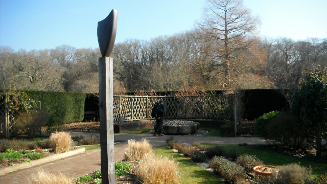
 Sheltered behind high hedges there are also a Physics Garden and a Sensory Garden (picture above and the two below).


 This is the view down the nave inside the church a remarkable testimony to the skills of the stone masons.

 This is a large mural in the Grange Restaurant in the grounds where mid-morning refreshment was taken.

 Leaving the Abbey grounds going back the road taken early the route then leaves the road after 500 metres along a fence and climbs steeply up to the ruins of Holy Trinity Church all that is left after an arson attack in 1992 https://www.achurchnearyou.com/buckfastleigh-holy-trinity/

 From the churchyard you get the fine view above back down to Buckfast Abbey. 

 This is a building erected over the tomb of Richard Cabell a seventeenth-century squire who was reputedly so evil he was buried under a large stone slab and a building was erected over it to ensure he could not escape. The stories associated with him served as an inspiration for SirAthur Conan Doyle's - The Hound of the Baskervilles https://historicengland.org.uk/listing/the-list/list-entry/1292829
 The route descends into Buckfastleigh and along Fore Street passing the Kings Arms in the picture above on the left. On the right just out of view is the Valient Soldier a museum created out of a pub that closed in the 1950's http://www.devonmuseums.net/The-Valiant-Soldier,-Buckfastleigh/Devon-Museums/

 Above is another shot of Fore Street further up the hill. Right at the end of the street can just be made out the The Globe Public House the destination for a late pub lunch. http://www.theglobebuckfastleigh.co.uk/

 Above a saying that seemed worth remembering and appropriate to a hiker. 

 The route out of Ashburton from the Globe PH is along Chapel Street and then Jordan Street on the west side of the valley containing the River Mardle - https://en.wikipedia.org/wiki/River_Mardle Six hundred metres from the urban edge the Dartmoor Way goes down a footpath to cross the River Mardle and climb up the other side to follow the road on the other side in the same north west direction through an agricultural area called Hockmoor. 

 After Hockmoor the route is down a bridleway through Burchett's Wood descending to follow the valley containing Holy Brook which rather naturally goes downstream in the opposite direction to Buckfast Abbey. See -  https://en.wikipedia.org/wiki/Holy_Brook,_Devon Above is a picture of the descending bridleway.

 Just before reaching the road at the other end the bridleway crosses the Holy Brook where fortunately there is a footbridge for pedestrians featured above. 


At the lane it is right and a short climb up to the farm at Mill Leat where the route is left off the road to follow a path on the north side of the Holy Brook valley. See picture above where Scorriton can be seen in the background.  It comes out on a lane and then it is left downhill to a nice white house in the bottom. The route leaves the lane going right for Langaford Cottage and goes anti-clockwise around the white house climbing to  a lane. The Dartmoor Way (and the Two Moors Way) is uphill along the lane to the right but the destination for an overnight stay was the hamlet of Scorriton. Across the lane was another path which again kept above the Holy Brook until reaching another lane. Then it was down to cross the Holy Brook and up to Scorriton.

 At the top of the hill is the Tradesman's Arms http://www.thetradesmansarms.co.uk/ and this is the view from one of the rooms at the back. The white house referred to above can be seen in the back left. 

 This is another view from the back looking across the valley of the Holy Brook towards the village of Holne in the top left.

Below The Tradesman's Arms

Wednesday, 5 July 2017

DARTMOOR WAY - STAGE FOUR

BOVEY TRACEY TO ASHBURTON

Bovey Tracey is in two halves divided by the River Bovey and the initial part of this days walk was downhill to the river and across the flood plain to ascend up through the housing on the other side.
This is the view looking back to Bovey Tracey across the flood plain.


My route took me to this place hidden in the residential area. Pottery Pond is artificial. It was excavated to provide a source of water for five waterwheels used by the local pottery industry. The clay that was excavated was used for fine pottery including Wedgwood's "Blue Ware". Now the pond is a wildlife sanctuary.  See http://www.geograph.org.uk/photo/5233819

Once out of the urban area it was following country lanes for a couple of miles to the village of Old Liverton.

Then it was a climb up through woods and footpaths to the ridge at Rora Down. Above is the view towards Dartmoor. 

The ridge connected to Ramshorn Down where there is the above view back towards Bovey Tracey.

The route follows this track down to a road and then down a track to Coombe Farm.  From here it was paths following streams through woods following the River Sig to the hamlet of Sigford. From here the route initially followed Langworthy Brook but from Owlacombe Bridge tt was then a long steady climb up a minor road through an area where there were tin and arsenic mines to cross a ridge at Owlacombe Cross.  Then it was a long steady descent into another valley and Waterleat. Then it was paths through woods following the River Ashburn with a former woollen mill on the opposite bank. I seemed to have neglected to take some photos of this section.

  The arrival in Ashburton -  must have bashed on because it was only 14:30. http://www.ashburton.org/ Still time for refreshment. This was another old Stannary Town like Chagford so again was on a much larger scale with every facility.
It was here my solo walk came to an end and I was joined by an old walking companion Dave who was coming with me to Tavistock. The overnight accommodation was out of town. It was a steady climb up passing the Church of Saint Andrew which is a distinguished building with an impressive exterior and a magnificent tower 92 feet high. See http://www.ashburton.org/churches.htm

The Dartmoor Way led up hill along a minor road and then steeply down to Knowles Cross where we left the route down another road to our hotel on the Dartmoor Lodge Hotel, Peartree Cross, Ashburton TQ13 7JW.  See www.dartmoorlodge.co.uk 

Thursday, 29 June 2017

DARTMOOR WAY - STAGE THREE

NORTH BOVEY TO BOVEY TRACEY

The thing that these two settlements have in common is reflected in their names - the proximity to the River Bovey and it and the valley in which it is located was never far out of view on this stage of the journey. See https://en.wikipedia.org/wiki/River_Bovey Lots of minor lanes, bridle roads and forest tracks but not a lot to write about.

 The start was down through the village to the River Bovey along a byway.

 On reaching the river there is this attractive set of stepping stones but the route did not take me that way. Instead the byway took me over Dickford Water via Dickford Bridge  to the hamlet of Barnefield. 
 As the route descended down a lane to the River Bovey this was the view across the fields back towards North Bovey. Clapper Bridge was at the bottom.

 The lane climbed up the other side and after a left turn down another lane this attractive garden complete with statues was at Neadon. 

 Footpaths and bridleways above the valley of the Bovey led to Horsham ( a small collection of buildings nestling in woods) and on to the village of Water. I chose not to deviate into the village where there is the Kestor Inn http://www.kestorinn.com/  The route continues down a lane to Beckhams and then the route is through Houndtor Wood, descending to follow the River Bovey to Drakeford Bridge.

 After you break out of the woods near Drakeford Bridge there is this long grass meadow adjacent to the river.

 After Drakeford Bridge the route goes under a disused railway bridge and then the former track and the river are followed for 3/4 of a mile. The route then follows a footpath above the old railway track now a cycleway where the above picture was taken . 

 After crossing the A382 Bovey Tracey is reached and the route is up through some houses to the Cromwell's Arch - all that is left of an ecclesiastical building. https://historicengland.org.uk/listing/the-list/list-entry/1003831

I stayed the night at the Cromwell Arms http://www.thecromwellarms.co.uk/
 which proved to be another good choice. I had time for a wander around the town - http://www.boveytracey.gov.uk/

Wednesday, 28 June 2017

DARTMOOR WAY - STAGE TWO

CHAGFORD TO NORTH BOVEY

Chagford is an ancient stannary town, where miners brought their tin in to be assessed and weighed, and where offenders against the miners' laws were tried. This past status reflects itself in its architecture which sets it apart from other settlements in the area. Refreshed after a good nights rest and a wholesome breakfast it was back to the pretty Square in Chagford and after purchase of provisions in a convenience store it was downhill to the River Teign.

At the bottom was this delightful and unusual swimming pool fed by water from the river. Alas it was not open as the hour was yet early. Well worth seeking out if you are in the area. http://www.chagfordpool.co.uk/

 Next to the swimming pool is Rushford Mill Farm and the walk goes through the farmyard and then follows the banks of the River Teign flanked by lush green meadows.  This section of the path is also part of the Two Moors Way.

 The path goes into some woods and then reaches Dogmarsh Bridge carrying the A382. The route is straight across the road. 

 The field ahead was dotted with cows , the riverside path is on the right in the above picture

At one point a small wood comes close to the river  and after another field the Two Moors Way goes left up a valley to Castle Drago while the Dartmoor Way continues to follow the river and enters a beautiful wooded section. 


There is the odd climb over rocky outcrops preventing passage adjacent to the river.


 This section ends at Fingle Bridge which is crossed and a steep ascent out of the valley commences.

 Immediately next to the bridge is this attractive watering hole, it was too early to investigate it however. See http://www.finglebridgeinn.co.uk/

The climb out the valley was going to take me an hour and a half. This was the first stop for water and a rest. 

 This was the second stop looking back along the wooded valley of the River Teign that I had followed.

 This was the third stop as the view east towards the ridge of Broadmoor Common opened up. 

 I deviated (as recommended) off the route to look at Cranbrook Castle an ancient hill fort 337 metres above sea level. https://historicengland.org.uk/listing/the-list/list-entry/1003860

 It was here that I succumbed to the desire to consume some of my provisions and enjoy the panoramic views. 

 Broadmoor Common again - see the difference in height from the earlier photo.
 After returning to the path the route then skirts Butterdon Down (above) and then descends through woods and fields to Moretonhampstead. http://visitmoretonhampstead.co.uk/

The Bell Inn was the first pub I got to and now short of water was glad to have a couple of pints in it. It is one of those places that has struggled commercially over recent years but has a long history. http://www.moretonhampstead.org.uk/texts/places/inns/bellinn.ghtml 

 The town was on a slight hill and the Dartmoor Way descends to cross Wadley Brook and then climbs up the other side and this is the view looking back.

 As the route continues slowly up to cross a ridge passing through a number of fields the town is still visible in the distance. Finally after crossing a minor road it disappears and there is a gradual descent to North Bovey.

I made a good choice for overnight lodgings at the Ring of Bells. A huge double bed and gigantic bathroom. Good bar food and ale what more could one want! http://ringofbells.net/