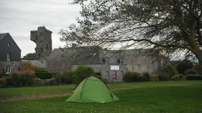
REGNEVILLE-SUR-MER TO COUDEVILLE PLAGE 11.68 MILES
Summary - We left the hotel and headed south along the coast passing the ruins of the castle at Regneville. After crossing a creek and working along the edges of fields we reached Hauteville-sur-Mer and walked along the sea front. When it ended the route was on the landward side of sand dunes for 20 minutes. Then it was inland mainly following vehicular tracks. At Les Hardes we paused to look at a large creek where the tide had gone out leaving boats high and dry. 2 miles later at Les Salines we had the disappointment of finding the restaurant we intended to use for lunch full up with no spare tables. We pushed on along a road that goes underwater at high tide. We headed for the seafront at Saint-Martin de Brehal. The first restaurant had finished serving and we were saved by a Pizza parlour who dished up a magnificent chicken one. Just under a mile further down the seafront we were at Coudeville Plage and the plush Le Relais des Isles. It started to rain that evening but we did not need to venture out as there was a good restaurant.Route description:- We left the hotel by walking along a path next to the coastal fringe on the top of a sea wall. Just inland was the coast road. (see photo below).
After 0.19 miles we could see inland the remains of the castle at Regneville. (Picture below).
Before the start of the 14th century, Charles (called ‘the bad‘) , King of Navarre, inherited huge possessions in Normandy including the fiefdom and castle of Regneville. During the 100 years war, the English king invaded the Cotentin, and Charles became allied to the English. When the English gave up the invasion of Normandy, Charles found himself alone against Charles V, the king of France. A civil war then took place between the rival camps and Charles the Bad resisted so effectively that a peace treaty was finally negotiated. Extract from http://www.otcm.fr/en/index.php?page=regneville where there is more about the history of the castle and Regneville.
At 0.29 miles the coast path joins the road and the route is then along the footway on the coast side of the road. Where there is a boat yard on the seaward side there is a fork in the road and it is right on the D156 signposted to Hauteville-sur-Mer. The minor road gradually rises until you have elevated views over the coastal marshes. At 0.99 miles go straight on at a crossroads with minor roads. At 1.33 miles at another cross roads with picnic tables in the central green it is right downhill on the road along a straight road which crosses a marshy creek and a watercourse called the Canal de Passerin. At 1.49 miles on the other side of the creek ignore the paths on the sea wall both sides and continue on the road. At a cross roads at 1.62 miles go straight on again. At 1.70 miles turn left into a car park entrance but then go straight on along a grassy path and not right. At 1.81 miles the path goes left then almost immediately right. It was in this path fenced on both sides we had to get around a horse that had somehow got out of the adjoining fields and into the fenced path. At 1.90 miles it is right and at 1.97 miles on approaching the landward side of sand dunes it is left again, 2.08 miles right again, 2.10 mile left again, 2.22 miles right again now along the edge of a holiday park over the sand dunes. On reaching the beach at 2.32 miles it is left along a promenade path. At 2.55 miles it is necessary to leave the beach to get around a caravan park and go over the sand dunes to a car park and then along the Avenue de la Brequette on a segregated path on the right side of the road. Take the first road on the right, the Rue des Garennes (2.68 miles). At the end of the straight it bends left and then right and at a cross roads there is a car park on the right (2.86 miles). We spotted a bar off to the left, the Bar L'Espar and diverted left for a mid-morning break, there was also a street market in full swing on the adjoining road. The route however is to the right along the Avenue de L'Aumesle and at 2.96 miles the beach promenade in Hauteville-sur-Mer is reached and it is left along it. Depending on the state of the tide there can be a large sandy beach or none at all (see picture below).
At 3.46 miles the end of the promenade is reached (see picture below) and there is a view along a beach with sand dunes backed up behind it. The route goes inland here so there is no requirement to plod through the wind blown sand,
Leave the beach passing a boat park on the left and go straight on down the Avenue du Sud with a sailing club on the right take the next road on the right signposted to Annoville (3.52 miles). Walk to the end of the straight and then around to the left where there is a car park on the right, just beyond it at 3.78 miles there is the waymarked start of a track which becomes a grassy path along the landward side of the sand dunes on the right which are piled up against the beach. The path ends at 4.50 miles at a tarmac road and a car park giving access to the beach. Turn left here along the road heading away from the beach with grass covered dunes on both sides initially. At 4.73 miles ignore an unsurfaced vehicular track on the right after which there are woods on the right. At 4.91 miles at a cross roads take the roughly surfaced vehicular track on the right. Follow it into a land of holiday homes. On reaching another cross roads with the Rue de Chaussey at 5.37 miles, go straight across and continue on the unsurfaced road ahead. At 6.68 miles another road is reached and go straight across again along another vehicular track with a ditch on the right and homes on the left. At 5.77 miles at a cross roads of tracks go left until at 5.95 miles a T-junction is reached, turn right here along another roughly surfaced track. After a few bends at a cross roads (6.17 miles) with a tarmac road go straight across along another roughly surfaced road. After a bend to the right and then to the left and after a track off to the left take a footpath on the right which leads briefly to the shoreline where at 6.69 miles we took the opportunity for a rest with the lovely view below across the sandy estuary pictured below.
The path then leads inland again and at 6.80 miles emerges onto a tarmac road. Follow it around right as it leads into the village of Les Hardes. Follow the road until a cross roads is reached and turn right along the road. At 7.43 miles the road crosses a stream which has caused the detour from the coast. At 7.51 miles take the next road on the right. At 7.60 miles at a fork take the tarmac road on the right and at 7.79 miles just before a farm take a left fork, at 7.90 miles fork left again, at 7.96 miles turn right and at 8.03 miles turn left. This vehicular track runs between sand dunes on the right and cultivated fields on the left and is called Chemin des Horvees. It exits onto a tarmac road at 8.51 miles in the village of Les Salines. Turn right along it through the village. The shore is behind the buildings on the right. Ignore the D442 off to the left at 8.71 miles and continue straight on within the village. Our pace quickened as we knew there was a restaurant called La Passerelle ahead at the next T-junction at 9.01 miles. Sadly our request for a table was rejected with the firm statement they were full. The diners in the window watched two dejected pilgrims head west down a road that is submerged at low tide as it crosses a wide creek. At 9.42 miles and on the other side of the creek and just before a crossroads take a path across marshland which is a shortcut to the road that you would have reached had one gone left at the crossroads ahead. On reaching the road (9.68 miles) go left along it. After leaving the marshland associated with the creek and after passing a caravan park on the right turn right down a footpath to the left of the entrance to the caravan park which leads over the dunes to the beach. (See the picture below)
At 10.21 miles at the top of the dunes, do not descend to the beach but take a path to the left that runs along the top of the dunes with a golf course inland until at 10.42 miles it joins the end of the promenade at St-Martin de Brehal. We walked along the promenade looking for food. Where the main street through the resort reaches the beach (11.03 miles) was a restaurant but we were rebuffed again this time because they had finished serving, Going inland we were successful in being the last to be served in the Pizza place shown in the picture below. The beer and the huge well stocked pizzas went down very well.
Returning to the sea front two happy pilgrims continued south along the promenade. (Picture below).
We did not have far to go, at 11.68 miles the promenade came to and end and across the other side we could see our hotel for the night.
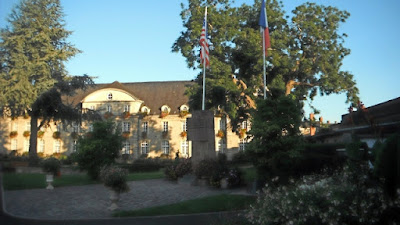
Accommodation :- We stayed at Le Relais des Isles, 3 Avenue de la Mer, 50290 Coudeville-sur-Mer Telephone +33 2 33 61 66 66 which was booked through Booking.com. Reception and the restaurant is on the third floor and we were upgraded at no cost to a room on the front at the second floor from where we could see the sea and the Chaussey islands off shore. The accommodation was good exceeding expectations even and the hotel was well maintained and well appointed. The restaurant had sea views as well as a number of maritime artefacts and model boats and served an excellent evening meal. The breakfast was excellent too so we gave the establishment 9.3 out of 10.


