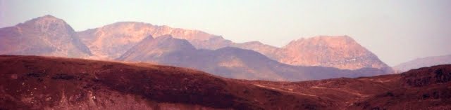
Snowdon Range

Snowdon Range
Snowdon Range from Moelwyn Mawr

Monday, 20 July 2015

ANGLES WAY - JULY 2015 - DAY THREE

NORTH COVE NATURE RESERVE TO BUNGAY


Summary - Another very hot day, 26c in the shade low 30's in the sun. Started where we left off yesterday at the North Cove Nature Reserve and returned to the banks of the River Waveney which we followed for four miles. The grass had been cut but it was rough going underfoot. After watching the Beccles Sailing Club doing races in the river we entered Beccles. It is a smart historic town on a hill in a bend in the river with several marinas below it. Lunch was taken in a pub in the little square. We then continued through fields to Bungay. Not very photogenic as it was miles of ripening corn fields with a few fields of rape and maize. Glad to finish today as it was very hot. Did 12.1 miles.

 Jim and I started again from the small car park at the North Cove Nature Reserve where the GPS was reading -6 feet. North Cove is a quiet relaxing place with a patchwork of wetland habitats including grazing marsh, wet woodland and pools, all lying in the valley of the River Waveney. Characteristic marshland plants like ragged-robin and yellow rattle (so named because the dried seeds rattle in their pods) have become established along with nationally scarce marsh fern which is thriving here. Bog pimpernel occurs in the meadow and opposite-leaved golden saxifrage can be found near the old decoy pond.The reserve is also a great site for fen meadow plants. The mature woodland is good for birds like warbler, siskin, redpoll and all three types of woodpecker. Woodcock nest and feed in the scrub and young carr and sparrow-hawk can often be seen hunting, their swift swooping flight low to the ground. Extract from http://www.suffolkwildlifetrust.org/reserves/north-cove
We were soon back on the banks of the River Waveney heading generally west towards Beccles, the above picture was taken near where the path through the nature reserve meets the river banks which prevent the marshes being flooded.

There are places where river boats can tie up overnight. This was the one at the end of Marsh Lane.

To maintain the marshland habitat and to prevent encroaching scrub, cattle are used in the summer months. They cannot wander freely as large ditches make a patchwork of different fields.
 
Every now and then was the sound of a boat passing partially or whole obscured by the riverside vegetation. This picture was taken from one of many locations used by a fishing club where a view up the river could be obtained.

This is part of the abutments of a former railway bridge over the River Waveney on the former line from Beccles  to Aldeby and on the Yarmouth South. It was closed on 2 November 1959.
 

This nice property sits on the river bank near Boathouse Hill.

As we approached Beccles we came across members of the Beccles Sailing Club having races around buoys in the river. http://www.becclesasc.co.uk/

Time for a break on a bench for a drink stop as we watched the competition heating up.

It was then on under the A146 (the Norwich Road) and to follow the quays of a marina, over a footbridge from which this picture was taken and into Beccles. Here the Angles Way follows Fen Lane and Northgate.

On reaching a square called "Old Market" we diverted into the Bear and Bells for a lunch and a pint.
https://en.wikipedia.org/wiki/Beccles for more about the town.
We left Beccles along a road called Puddingmoor until reaching the Bungay Road (B1062). After walking along this busy road passing Roos Hall it was back onto farm tracks again. The route passes to the south of the remains of Barsham Hall with views to the south towards Barsham and its church.

Ripening crops were everywhere including trees with wild cherries.

Rape was also a popular crop this year https://en.wikipedia.org/wiki/Rapeseed

The Angles Way goes to the hamlet of Shipmeadow and we stopped in the churchyard for a rest and a drink. Unfortunately it did not have a seat and was locked. This is the view from the church north over the valley of the River Waveney.
 
The route then is through fields but there is a good view across at what is called on the map "Viewpoint Mews" but was the Wangford Union Workhouse http://www.workhouses.org.uk/Wangford/
It was now very hot and the field side paths through the corn and bridle roads to Highfields Farm were taking their toll. A brief section of road through Crow's Nest Wood and passed Moat Cottages and then it was back to unsurfaced lanes between hedges.

Nearing the end of today's walk we came over a rise to a view of Bungay where we had parked a car in a road called Annis |Hill.

Thursday, 16 July 2015

ANGLES WAY JULY 2015 - DAY TWO

DAY TWO - ASHBY TO NORTH COVE NATURE RESERVE

 Summary - A beautiful sunny day 25 C real holiday weather. We started at Ashby Hall Farm about 1.5 miles north of Somerleyton. Heading south we stopped to inspect St Michael's Church another one with a round tower. It was locked but we enjoyed the cherries on a tree in the graveyard. Stopped at Somerleyton which has a large stately home and some beautiful thatched houses, Stopped at the post office to get some shaving cream and a Bakewell Tart. This village was where the hovercraft was invented. The next four miles were along overgrown paths above marshes, hot sticky going with high humidity, Civilisation was reached at Oulton Broad a real tourist hotspot with lots of boats shops and boats that take tourists around the waterways. Commodore Pub did us well and there were lots of people sunbathing and eating in the garden. This was soon left behind as the next five miles was closely following waterways on raised embankments, Views over the marshes on one side and boats passing on the other. Finally we diverted through North Cove Nature Reserve to where we had left a car. 13.5 miles and still feeling fit.

This is a sun dial on the south side of the church tower at Ashby just a quarter of a mile after we had started.

The Church of St Mary was locked so after an exploration of the churchyard and the consumption of some of the cherries on one of the trees we carried on. The following s an extract from http://www.lothingland.co.uk/ashby4.htm
To the left of the gate as you enter the churchyard is the memorial stone to the 7 USAAF airmen who were killed nearby in the last war. The first five were of the 100th Bomb Group stationed at Thorpe Abbotts, nicknamed the "Bloody Hundreds". A number of Flying Fortresses set off on the early morning of May 7th, 1944, for a raid on Berlin. One caught fire before it reached the east coast. Several dozen signal flares in cartridges stored in the top turret compartment, for some unknown reason, started to explode and set on fire the entire front of the plane. Though the top turret gunner tried to put out the flames, the cabin was filled with smoke. Moving to the forward hatch to make his escape he found it blocked by the body of a man whose parachute was outside the plane. Five of the crew escaped through the gun turret while the pilot kept the plane steady, but the remaining five, including the pilot and co-pilot, died in the crash and explosion nearby. Their names were:-
  • 1st Lt. Ralph W. Wright Lt. Jack W. Raper
  • Lt. Richard Curran Lt. Carl A. Herrmann
  • The second two names:-
  • Lt. Russel P. Judd F/P. Louis S. Davis
commemorate two men from the American 5th Emergency Squadron based at Halesworth. The second crash occurred on the 8th April 1945 when they collided in two USAAS P47 Thunderbolts over Fritton Lake, whilst either returning from an air-sea rescue mission or just practising aerial manoeuvres. One went into the Lake and parts were recovered later from the Lake in 1971 and were exhibited at Fritton Hall, the other crashed in the field opposite White Lodge, fragments being scattered over a wide area. From the recovery from Fritton Lake, the port wing was presented to the USAAF Museum at Wright Patterson Air Force base, Ohio, where it is on exhibition

The Angles Way hen follows farm tracks through fields. These crops were of potatoes but we also found wheat, barley, maize, carrots, leaks, unions, sugar beat, broad beans on the route.

The route passes through Somerleyton and this is the attractively designed primary school.

The village sign on the green.

Many of the houses consist of a model village built around a green that once belonged to the Somerleyton Estate. As we passed through the school seems to be practicing for sports day.

Somerleyton was the home of Christopher Cockerell where he invented the hovercraft using the resources of 'Ripplecraft' a business operating cabin cruisers for the boat hire trade serving holidaymakers cruising the Norfolk Broads. Unveiled in 2010 the Hovercraft Column above commemorates Cockerell's invention. https://en.wikipedia.org/wiki/Christopher_Cockerell
At the western end of the village is this nice pond complete with dozing ducks.


The Angles Way enables you to have this brief view of the Somerleyton Marina. From there it is along a path that gets one close to the railway station and then goes along Station Road and Waddling Lane out into fields that are slightly higher than the flood plain and marshes along the River Waveney. We deviated from the route on the Ordnance Survey to follow a footpath closer to the river although there was more undergrowth to cope with. The path continues above Blundeston, and Flixton Marshes and then you get to Camps Heath Nature Reserve where there is a display board,

This is St Michael Church at Oulton which was locked.
 
This is Oulton Broad the most southern area of open water in the Broads system, and it is a busy tourist and sporting centre. It is used for a variety of water sports, including powerboat racing, and as the base for boat hire.  Facilities include a yacht station and moorings as well as a 'village' of holiday chalets. It is one of the few broads with residential areas adjacent, with houses to the north and flats to the east. The north side of the Broad is one of the most expensive residential areas in Lowestoft, with large detached houses having lake frontage and it is through this plush area that the Angles Way goes in order to get to this view point.
The Commodore Inn was the lunch stop and this is the rear garden.

To the east the Oulton Broad is linked by this lock to Lake Lothing which passes through the centre of Lowestoft and opens into the North Sea. To the west it is linked by Oulton Dyke to the River Waveney.

There are no footpaths along the Oulton Dyke but the Angles Way keeps close to it through the Carlton Marshes Nature Reserve in which there are numerous drainage ditches like this one.

From the recently restored flood embankments you get this view over |Peto's Marsh which has been restored sufficiently to support a corn crop.

The route then joins the embankment going upstream along the River Waveney although along most of the way there is an area of marsh separating you from the waters edge.

The embankment is well maintained and thankfully the vegetation is cut back. The Angles Way uses it all the way to Beccles.
 

Away from the river there are herds of cows feasting on the summer growth in the marshes.

Cruise boats pass by at regular intervals.
We diverted off the river bank to the North Cove Nature Reserve where we had left a car in a small car park near Wade Hall, Barnby.

ANGLES WAY - JULY 2015 - DAY ONE

DAY ONE - GREAT YARMOUTH TO ASHBY

Summary - We had a 12.5 mile walk on Day One and the weather was fine. We left Great Yarmouth Station where the Angles Way meets two other paths and went along the banks of Breydon Water. Lots of birds on the marshes and boats going up and down. Stopped to look at a church and  Roman Fort and have lunch in a pub at Burgh Castle and then continued inland following roads and tracks through rather flat countryside. Nothing spectacular in the afternoon but there was a church at Finton with old paintings on the walls. By hay it beats working!

WHO WERE THE ANGLES - The Angles (Latin Anglii) were one of the main Germanic peoples who settled in Britain in the post-Roman period. They founded several of the kingdoms of Anglo-Saxon England and their name is the root of the name England. The name comes from the district of Angeln, an area located on the Baltic shore of what is now Schleswig-Holstein, the most northern state of Germany. Extract from https://en.wikipedia.org/wiki/Angles

This is the Three Ways Meeting point next to Great Yarmouth Station where we parked all day in the pay and display car park. The Wherryman's Way from Norwich, the Weavers Way from Cromer and the Angles Way from Thetford meet up at this marker point.
 

The first few steps are across the Vauxhall Bridge over the River Bure which is being restored by the Great Yarmouth Preservation Trust. http://www.greatyarmouthpreservationtrust.org/en/projects/vauxhallbridge


The route is well waymarked throughout although some in fields have been uprooted. There is a variety of types of waymarks, this one was just after the Vauxhall Bridge.

The Haven Bridge over the River Yare is  a modern one where you can view part of the dock wharfs downstream.

This is a mural on the side of a house at the junction of Critten's Road and Isaac's Road.

A path leads towards the lifting Breydon Bridge which takes the A12 over the River Yare. The river starts south of Dereham and runs through Norfolk passing to the south of Norwich and is joined by the River Waveney and the River Bure before passing through Great Yarmouth to the sea
In the picture is Jim my long suffering companion on this trip

Breydon Water (part of the River Yare) is strongly tidal and this old sailing boat was trying to make headway upstream.

The path along the south bank of Breydon Water goes for over four miles on a flood embankment from where there is good views across to the mud flats on the other side. Godwits and Avocets were seen by an ornithologist with an impressive camera.

A number of old wrecks litter the shore whilst holiday boats enjoying the Broads come down to Great Yarmouth and then go up the Bure,  the Yare or the Waveney exploring the Broads. At one point ten of them could be seen.

Along some sections sheet piling had been put in to raise the effective level of the flood embankments.

This barge powered by sail and outboard motor passed swiftly down stream.

On the opposite bank can be seen the  Lockgate Drainage Pump http://www.norfolkmills.co.uk/WindmillsD/halvergate-lockgate-drainage.html and the
Berney Arms Drainage Mill. At 21.5 metres high it is the highest of its type in Norfolk although located in an isolated spot. https://en.wikipedia.org/wiki/Berney_Arms_Windmill
Both are located on the River Yare but we were to take the left fork in the river system which is the River Waveney and the Angles Way goes all the way to its source.

The south bank of the Breydon Water which is 5 km by 1.5 km and is a large protected wetland

This is a stained glass window in the church below which marks the passing of the reigns of Queen Victoria and King Alfred a thousand years apart - 901 and 1901.

The church of Burgh Castle, St Peter and St Paul is one of 124 existing round tower churches in Norfolk.

Breydon Water from a view point just north of Burgh Castle

The outside of the north wall of Burgh Castle a Roman fort constructed as a defensive fort against raids up the east coast. It is called Gariannonum. It is rectangular but one of the walls has fallen into the estuary. There is nothing to see inside but it is freely open to the public.

The way in from the north through a gap in the wall caused by a collapsed watch tower.

This is the inside of the fort from the north west. It is in the care of the Norfolk Archaeological Trust and their web site explains the history of this part of the world in Roman times.

An artists impression (taken from a display board) of what the view from the now lost west wall might have looked like down on to jetties on the much larger estuary that existed then.
From here it is a short walk to the Fisherman's Inn where we had lunch and a pint of ale. http://www.burghcastlemarina.co.uk/the-fishermans-inn/ 

After passing around the back of the marina we did a short section of the River Waveney before heading inland through the village of Belton which seemed to have an example of every style of dwelling architecture in the last 150 years.

We left Belton on Back Lane running next to Belton Common which has been a source of sand extraction.

This section of the lane was like a sandy beach.

The Angles Way goes through fields to the village of Fritton.

The church of St Edmund at Fritton

One of a series of old wall paintings exposed in the church.
From here the Angles Way goes through Fritton passing the Decoy Tavern and then takes a bridleway down into a marshy valley just downstream from Fritton Lake. Climbing out of the valley it joins Blocka Road which is followed east. There was a lot of cars using this route so we were glad to get back to the field side paths in the direction of Beech Farm and then we left the Angles Way to go to where we had parked the car near Ashby Hall Farm.