Snowdon Range

Snowdon Range
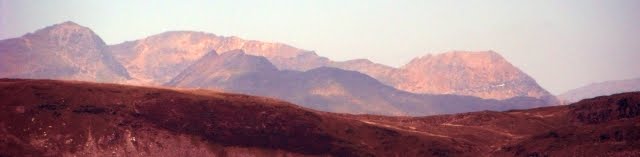
Snowdon Range from Moelwyn Mawr

Wednesday, 28 June 2017

DARTMOOR WAY - STAGE TWO

CHAGFORD TO NORTH BOVEY

Chagford is an ancient stannary town, where miners brought their tin in to be assessed and weighed, and where offenders against the miners' laws were tried. This past status reflects itself in its architecture which sets it apart from other settlements in the area. Refreshed after a good nights rest and a wholesome breakfast it was back to the pretty Square in Chagford and after purchase of provisions in a convenience store it was downhill to the River Teign.

At the bottom was this delightful and unusual swimming pool fed by water from the river. Alas it was not open as the hour was yet early. Well worth seeking out if you are in the area. http://www.chagfordpool.co.uk/

 Next to the swimming pool is Rushford Mill Farm and the walk goes through the farmyard and then follows the banks of the River Teign flanked by lush green meadows.  This section of the path is also part of the Two Moors Way.

 The path goes into some woods and then reaches Dogmarsh Bridge carrying the A382. The route is straight across the road. 

 The field ahead was dotted with cows , the riverside path is on the right in the above picture

At one point a small wood comes close to the river  and after another field the Two Moors Way goes left up a valley to Castle Drago while the Dartmoor Way continues to follow the river and enters a beautiful wooded section. 


There is the odd climb over rocky outcrops preventing passage adjacent to the river.


 This section ends at Fingle Bridge which is crossed and a steep ascent out of the valley commences.

 Immediately next to the bridge is this attractive watering hole, it was too early to investigate it however. See http://www.finglebridgeinn.co.uk/

The climb out the valley was going to take me an hour and a half. This was the first stop for water and a rest. 

 This was the second stop looking back along the wooded valley of the River Teign that I had followed.

 This was the third stop as the view east towards the ridge of Broadmoor Common opened up. 

 I deviated (as recommended) off the route to look at Cranbrook Castle an ancient hill fort 337 metres above sea level. https://historicengland.org.uk/listing/the-list/list-entry/1003860

 It was here that I succumbed to the desire to consume some of my provisions and enjoy the panoramic views. 

 Broadmoor Common again - see the difference in height from the earlier photo.
 After returning to the path the route then skirts Butterdon Down (above) and then descends through woods and fields to Moretonhampstead. http://visitmoretonhampstead.co.uk/

The Bell Inn was the first pub I got to and now short of water was glad to have a couple of pints in it. It is one of those places that has struggled commercially over recent years but has a long history. http://www.moretonhampstead.org.uk/texts/places/inns/bellinn.ghtml 

 The town was on a slight hill and the Dartmoor Way descends to cross Wadley Brook and then climbs up the other side and this is the view looking back.

 As the route continues slowly up to cross a ridge passing through a number of fields the town is still visible in the distance. Finally after crossing a minor road it disappears and there is a gradual descent to North Bovey.

I made a good choice for overnight lodgings at the Ring of Bells. A huge double bed and gigantic bathroom. Good bar food and ale what more could one want! http://ringofbells.net/

Tuesday, 27 June 2017

DARTMOOR WAY - STAGE ONE

OKEHAMPTON TO CHAGFORD

The children were off to school as I set out in the morning. I went via the Museum the official start of the walk and headed south east out of town.

The route passes Town Mills (above) dating from the 18th Century complete with water wheel. The route then follows the mill leat out into the countryside 

After passing under a railway line and the A30 the route starts to climb with ever improving views to the north west.

The view from Tor Down 299 metres. 

A lane leads to the village of Belstone. This is the view looking back to the village and the Tors Inn. http://thetorsinn.co.uk/

From Belstone the route descends steeply into the wilds of the valley of the River Taw. https://en.wikipedia.org/wiki/River_Taw 

 This wooded valley was made famous by Henry Williamson in his book about Tarka the Otter.https://en.wikipedia.org/wiki/Tarka_the_Otter

 The route emerges from the wooded valley into the village of Sticklepath where the National Trust has a working 19th Century water-powered forge. See https://www.nationaltrust.org.uk/finch-foundry

 After crossing the River Taw and climbing over a ridge the route descends through the village of South Zeal.

 It is a stiff climb up out the village of South Zeal to Ramsley Hill where I took this selfie with Dartmoor and Cosdon Hill in the background. Here are the remains of the Ramsley Copper Mine.

 After some undulations minor lanes and footpaths I arrived at the Church of Saint Mary the Virgin at Throwleigh. http://throwleigh.org/ The church that day was hosting a mobile post office.

 The next section is along an ancient narrow path called Deave Lane with good views to the east. At Wonson I made a minor diversion off route to the Northmore Arms where I had a pint and a pudding to keep me going. A real ale treat. https://www.thenorthmorearms.com/

 This picture was taken on the subsequent descent to Coombe down another unsurfaced  bridle road. 

 The route from Sticklepath was largely following the Taw-Teign link and this was the descent from Murchington towards the River Teign.  https://www.ldwa.org.uk/ldp/members/show_publication.php?publication_id=1957

 I took this picture across the Teign valley from the bathroom of my B&B in Chagford. 


I stayed here (the one with the stone façade) at Cyprians Cot, 47 New Street, Chagford. http://www.cyprianscot.co.uk/ a 16th Century house with amazing stonework. I remember distinctly the colossal  spread for breakfast.


For those with plenty to spend on lodgings there is this stone masterpiece in the centre of Chagford in High Street - The Three Crowns Inn. http://threecrowns-chagford.co.uk/

I went to the Ring O Bells a nice welcoming pub at 44 The Square where I consumed my evening meal with relish. http://www.ringobellschagford.co.uk/contact-us

DARTMOOR WAY

INTRODUCTION

The Dartmoor Way is a well established cycleway details of which can be found at http://www.dartmoorway.co.uk/home.php The web site has promised a walking route for some time but I had in my collection of books the one below. You can still get it as a second hand book and a search on the web will enable you to track one down. It has been written to do the walk in 24 circular walks. If you want to do a linear route you have to take a section out of each walk. There was no waymarking associated with this book and the maps are poor so I translated the description on to OS Mapping. The walk was excellent and I found no problems in following the route and the rights of way were generally in good order.

The walk starts and finishes in Okehampton and I made my way by train to Exeter and from there by bus. 

I stayed here overnight at The Fountain Inn in Fore Street http://thefountainokehampton.co.uk and it was a traditional inn with a good bar menu and good beers and the room was spacious and comfortable.

I had time to look around and visited the Okehampton Museum at 3 West Street which is down the alley way off the main street you see in the picture above. It is the building at the end and on three floors. It has a tourist information section on the ground floor but ominously they had not heard of the Dartmoor Way. http://www.museumofdartmoorlife.org.uk/ It was a good introduction to all aspects of Dartmoor.

From there I walked to the castle with its ruinous keep but alas arrived just as the custodian was looking the gates for the day. http://www.english-heritage.org.uk/visit/places/okehampton-castle/


This is a picture of the White Hart Hotel before it was completely refurbished by Wetherspoons see https://www.jdwetherspoon.com/hotels/england/devon/the-white-hart which is another good option for food and drink.

Saturday, 5 November 2016

THE GREAT GOLD WALK, VICTORIA, AUSTRALIA

The Great Gold Walk, Victoria, Australia

A long distance path to the west of Melbourne, which takes walkers from goldfield town to goldfield town mainly along the State of Victoria's Great Dividing Range through a variety of landscape and heritage sites. Built over the last 20 years by Government Agencies and volunteers it is a continuous walking route with accommodation suitable for the average walker.

For the story of the development of the route visit the Facebook Page www.facebook.co/thegreatgoldwalkaustralia/

For full details of the walk go to the web site www.thegreatgoldwalk.com
Address for further queries thegreatgoldwalk@gmail.com

Sunday, 12 June 2016

SHAKESPEARE'S WAY

SHAKESPEARE'S WAY

The Globe to Stratford upon Avon


No need for me to give a detailed description of this walk as you can buy a guidebook from the official website for the walk at http://www.shakespearesway.org/ I completed this 146-mile walk on 24 May 2016. Decided to take the option of walking the route to Stratford upon Avon rather than to the Globe. The main guidebook does the route in the direction of the Globe but you can also buy a text only version which describes the route in the opposite direction.

For visitors to England this route contains a huge amount of historical interest along the route and you will need to allow plenty of time to see it all. Allow 14 days at least with a day to see The Globe and central London and another to see Stratford upon Avon and Oxford makes a good place to stop for a day off. Accommodation can be found using www.booking.com or https://www.smoothhound.co.uk/

When you get to Stratford upon Avon go to the visitor centre and ask for a copy of the leaflet "The Historic Spine". The central Premier Inn is well located for a stay here.

The route is mixture of sections along many other long distance paths and links between them and is generally in good condition. Included are sections along the River Thames, The Grand Union Canal, a traverse of the Chilterns and a route through Oxfordshire and Warwickshire that has some lovely villages and countryside.
Central London
The valley of the Thames
Descent to Hamble Brook
Stonor House
Descent from the Chilterns
Thames Path in Oxford
Blenheim Palace
Descent to Long Compton
William Shakespeare's grave
Shakespeare's birthplace