Snowdon Range

Snowdon Range
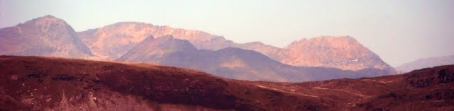
Snowdon Range from Moelwyn Mawr

Sunday, 4 October 2015

THREE SAINT'S WAY - DAY TWELVE

COUDEVILLE PLAGE TO LE PONT BLEU - 11 MILES

Summary:- Today did not go as planned, we lopped three miles off the day and added it to the next day. The weather was the cause. We intended to make Jullouville - Edenville for our overnight stop but we could not locate accommodation there. So the we planned to walk to Granville, get the bus to Jullouville - Edenville and then walk back to Granville where there were plenty of hotels. In the end we took the bus to Le Pont Bleu and left the section to Jullouville - Edenville for the next day. Strong winds and occasionally heavy rain made it hard going to Granville, a mixture of sand dunes and promenades. After lunch in Granville we took a bus to Le Pont Bleu and walked inland to Kairon and walked over some hills to Beausoleil and then followed the coast to Granville.

Route description:- Peering out the bedroom window did not encourage us to get on with the day. Rain was coming across the sea in belts, the car park outside was wet and the wind was creating big waves on the beach. The excellent views from the restaurant over breakfast confirmed our expectations of a hard day. We walked across the car park and picked up the promenade but it did not last long and we were directed by the waymarks to tracks through the area between a holiday park and the beach that was in the public domain. (picture below)


At 0.20 miles it was into the wilds of the sand dunes, up and down and hard going against the wind. At 0.60 miles the route goes passed the end of the Granville-Breville airport runway and then inland along an access to the beach (see picture below) until a large car park at the end of an access road. Go through the car park to the far left corner and it is on again across the dunes next to the coast.


At 1.43 miles another car park and access road to the beach is reached with a yachts club and boat park between the car park and the beach. The route goes left of the boat park but then leaves the car park at the right hand or western end to continue its route across the dunes. There is now a golf course inland and the track generally follows the boundary fence. At 1.84 miles there is a race course on the left and the dune plodding ends as a road is joined running along the west side of the racecourse with a car park on the right. Continue along the road and by 1.94 miles there is a caravan park on the right. At 2.04 miles the road bends left but the route is straight on along a well defined but sandy path. It bends left, then right and goes straight with a heliport on the left and sand dunes on the right and then joins another roadway at 2.23 miles. It was here that we had a burst of hail stones. Ignore the road to the left and keep straight on along the road. Ignore another two roads off to the left at 2.32 miles and 2.46 miles and then there is a caravan park on the left. Next comes a large car park on the right next to the beach and beyond it on the other side of the access road to the car park there is a large block of flats (2.66 miles). Pass to the right of it to find the path next to the beach shown in the photo below.


The path continues along the beach side and once beyond the building becomes a wide promenade which is followed towards a headland ahead. It was here that we saw three people with wet suits plunging into perilous looking waves, the only other people around. At 2.96 miles a road comes down from the left to join the promenade and then it rises towards the headland ahead. The route follows the road leaving the promenade and at a left hand bend in the road (3.07 miles) the route is up a set of steps and a path climbing to the road above. where the picture below was taken looking back.


The photo below was taken looking the other way along the coast

Once up on to the Rue de la Douane it is right along the cliff top until arriving at the Pointe du Lune at 3.35 miles where there is a grassy area with seats and a good view.


Follow the road around to the left away from the coast, the large wall blocking the way along the coast is part of a cemetery. Follow the road as it goes left and then right in a pleasant residential area and then turn right at 3.47 miles up the Rue du Cimitiere Notre Dame. On arriving at the cemetery entrance and a car park follow the road around to the left and follow it until at 3.58 miles you meet the D971es (Avenue de la Liberation) and enter Granville. Turn right and at 3.69 miles turn right up a road signed as the way to the Christian Dior museum and gardens the entrance to which is reached at 3.76 miles. We were in no fit state to go in the museum but we sneaked a view around the gardens (photo below).


Turn left at the entrance down the Rue Docteur Ollivier, the residential properties on the right are on the cliff top. Take the next road on the right the Chemin du Noroit (3.86 miles) and then take a path on the left which goes down the cliff face steeply with plenty of steps until eventually you emerge on the seafront promenade at the bottom and near some toilets and turn left. As you descend there is a good view towards the Pointe du Roc (see picture below). We had intended to go around it but the weather forced us to leave it out.


The Promenade du Plat Gousse leads to car park next to a Casino (4.15 miles). From here we struck left to a main road (Tranchee aux Anglais) and turned right and then went left through No-Entry signs down a shopping street (Rue de Paul Poirier) which leads to a triangular area with a war memorial in the middle (4.35 miles). Here we went into the Brasserie au Pirate for a lunch stop.

On exiting the bar we turned left to a bus stop and from here we were to take Maneo Bus No 4 along the coast to Pont Bleu a bus stop on the main road just beyond Kairon Plage. There is a bridge over a stream with blue railings and a restaurant nearby of the same name. The bus stop is 200 metres before you get to it at a bend in the road. Alighting from the bus we crossed the zebra crossing and turned right and then forked left down the Avenue de la Faisanderie. At the other end at 0.17 miles it was left into the Rue de la Folliotte which was to take us after a steady climb to the village of Kairon and its church at 0.73 miles. We were now on the Chemin du Mont St Michel but were to walk back to Granville to our hotel in the opposite direction and return here in the morning to continue on the route towards our destination. Passing to the left of the church we followed the Rue Saint Laurent steadily uphill and at 0.80 miles took a footway on the left up some steps and up to another road almost immediately. Here the route is straight on up a residential road called Chemin du Verchu. It leads out into the countryside and climbs passing to the left of a hilltop with seats and a picnic site on the top and a track leading up to it (1.07 miles). Storms were passing either side of us but we were very fortunate to miss them. As we descended we could see Granville in the distance. Ignore a track to the left (1.15 miles) and keep straight on now slowly downhill (photo below). 


At 1.43 miles a track joins from the right, at 1.57 miles a newly constructed road is reached which was not on our maps. Here it was straight across onto an old road (Kairon Plage was down the road to the left) and at 1.63 miles it was left off the road and immediately left at a fork of unsurfaced vehicular tracks. The track goes through countryside along the base of a hill on the right. At 2.10 miles the residential area of Beausoleil is reached and the track becomes a road.  At 2.18 miles a T-junction is reached and here the route is left to another T-junction with the D911 the main coast road and then right. To the left of the road is the beach and between a coast path. At 2.39 miles this path veers away from the road to the left where you get the view below down the coast to the south.


As it goes around the Rocher St-Gaud headland the path becomes a road (Allee de la Corniche) with residential properties blocking out any views. The road exits back onto the D911 again at 2.64 miles, turn left along it but soon turn left down an alleyway to the road below (Rue de la Fontaine St Gaud) and turn right. At 2.84 miles this road too exits onto the D911 and turn left here along it until you get to the lovely Chapelle Sainte-Anne in Saint-Pair-sur-Mer on the right featured in the picture below (3.03 miles). https://fr.wikipedia.org/wiki/Saint-Pair-sur-Mer


Go back down the road slightly and then right down the Rue de Scissy which leads at 3.18 miles to the coast and another promenade,  turn right. Where the promenade comes to an end at 3.36 miles turn right up the Rue Saint-Pierre. This exits onto a road just down the hill from the Tourist Office (3.42 miles). Turn left and at the next junction with the D911 again go left and then immediately left down a minor road that leads to the beach of St-Nicolas Plage (pictured below).


The route is along the beach to the other end where the route is up a ramp to the D911 again (3.86 miles). Turn left and follow the D911 and at 4.11 there is an Orientation Table at a viewpoint overlooking the cliff. Continue to follow the road until at 4.20 miles pick up a cliff top path that veers away from the road. The cliff area (La Crete) extends towards a headland on which a chateau is located. 


The path follows the clifftop around the headland at 4.44 miles descends some steps and climbs again and then goes in front of houses keeping to the cliff. At 4.70 it comes out onto a road at a bend, keep straight on keeping to the level section of road. At a T-junction (4.75 miles) go right and climb uphill and after the last house on the left another path starts up some steps on the left and initially runs behind the houses until the cliff top is reached again (4.90 miles). At 5.03 miles the path leaves the cliff and goes through a gap in a wall and continues away from the coast uphill (Chemin de la Roche Gautier). At 5.14 miles it exits on to a minor road called Rue de la Roche Gautier. Turn left and at 5.16 miles leave the road on the right to locate a path which descends steeply down some steps to the D911 and turn left downhill. At 5.26 miles turn left down a path with a rooftop car park to the left. It descends to a promenade overlooking a bay at the entrance to Port de Herel in Granville where you get the view below through the gaps in the port walls into an outer harbour. 


Follow the promenade until a Nautical Centre is reached at 5.42 miles and then go clockwise around it and back to the D911 again (5.63 miles). On route the harbour comes into full view - see the picture below.


Turn left along the road with boat parking on the left. At a cross roads (5.75 miles) turn right down Rue Clement Desmaisons and at a T-junction at the end turn left and then almost immediately right and ahead lies the war memorial and the bus stop from which we had departed earlier. We hydrated in the Brasserie au Pirate again.

Hotel accommodation:- We had booked a room through Booking.com in the Hotel Inn Design Resto Novo, 57 Avenue des Matignon, 50400 Granville. +33233500505. This necessitated a further walk. We retraced our steps back the way we had just come turning left this time passing the end of Rue Clement Desmaisons and continuing along the shopping street Rue Paul Poirier with its cobbled paving. At a gradual left hand bend it becomes the Rue Couraye. It steadily climbs, the cobbles end, and at 0.45 miles it is straight on at a roundabout where the railway station is off to the left and the Brasserie de la Gare is on the corner. Continue straight on uphill along another Avenue Marechal Leclerc. At 0.64 miles at another roundabout it is straight on again along the Avenue des Matignon until No 57 and below is the view that awaits (0.76 miles). The first disappointment was to find that advertised evening meal (Mondays to Fridays) was not available due to exceptional circumstances undefined. We were given Room No 1 close to reception. It was twin bedded with en-suite facilities but it was as small as you could possibly design. There was no ventilation save for a door that opened onto the front garden. It was clean and we could not fault its contents apart from size. The only place I could find to unload the rucksack was the bed and had to repack it before I could use the bed. Rotund persons would have a job getting into the shower. We walked back down to the Brasserie de la Gare and they provided a good meal. Breakfast was OK. We gave it 4.5 out of 10. Fine if you are looking for budget accommodation.


Friday, 18 September 2015

THREE SAINT'S WAY - DAY ELEVEN

REGNEVILLE-SUR-MER TO COUDEVILLE PLAGE 11.68 MILES

Summary - We left the hotel and headed south along the coast passing the ruins of the castle at Regneville. After crossing a creek and working along the edges of fields we reached Hauteville-sur-Mer and walked along the sea front. When it ended the route was on the landward side of sand dunes for 20 minutes. Then it was inland mainly following vehicular tracks. At Les Hardes we paused to look at a large creek where the tide had gone out leaving boats high and dry. 2 miles later at Les Salines we had the disappointment of finding the restaurant we intended to use for lunch full up with no spare tables. We pushed on along a road that goes underwater at high tide. We headed for the seafront at Saint-Martin de Brehal. The first restaurant had finished serving and we were saved by a Pizza parlour who dished up a magnificent chicken one. Just under a mile further down the seafront we were at Coudeville Plage and the plush Le Relais des Isles. It started to rain that evening but we did not need to venture out as there was a good restaurant.

Route description:- We left the hotel by walking along a path next to the coastal fringe on the top of a sea wall. Just inland was the coast road. (see photo below).


After 0.19 miles we could see inland the remains of the castle at Regneville. (Picture below).

Before the start of the 14th century, Charles (called ‘the bad‘) , King of Navarre, inherited huge possessions in Normandy including the fiefdom and castle of Regneville. During the 100 years war, the English king invaded the Cotentin, and Charles became allied to the English. When the English gave up the invasion of Normandy, Charles found himself alone against Charles V, the king of France. A civil war then took place between the rival camps and Charles the Bad resisted so effectively that a peace treaty was finally negotiated. Extract from http://www.otcm.fr/en/index.php?page=regneville where there is more about the history of the castle and Regneville.


At 0.29 miles the coast path joins the road and the route is then along the footway on the coast side of the road. Where there is a boat yard on the seaward side there is a fork in the road and it is right on the D156 signposted to Hauteville-sur-Mer. The minor road gradually rises until you have elevated views over the coastal marshes. At 0.99 miles go straight on at a crossroads with minor roads. At 1.33 miles at another cross roads with picnic tables in the central green it is right downhill on the road along a straight road which crosses a marshy creek and a watercourse called the Canal de Passerin. At 1.49 miles on the other side of the creek ignore the paths on the sea wall both sides and continue on the road. At a cross roads at 1.62 miles go straight on  again. At 1.70 miles turn left into a car park entrance but then go straight on along a grassy path and not right. At 1.81 miles the path goes left then almost immediately right. It was in this path fenced on both sides we had to get around a horse that had somehow got out of the adjoining fields and into the fenced path. At 1.90 miles it is right and at 1.97 miles on approaching the landward side of sand dunes it is left again, 2.08 miles right again, 2.10 mile left again, 2.22 miles right again now along the edge of a holiday park over the sand dunes. On reaching the beach at 2.32 miles it is left along a promenade path. At 2.55 miles it is necessary to leave the beach to get around a caravan park and go over the sand dunes to a car park and then along the Avenue de la Brequette on a segregated path on the right side of the road. Take the first road on the right, the Rue des Garennes (2.68 miles). At the end of the straight it bends left and then right and at a cross roads there is a car park on the right (2.86 miles). We spotted a bar off to the left, the Bar L'Espar and diverted left for a mid-morning break, there was also a street market in full swing on the adjoining road. The route however is to the right along the Avenue de L'Aumesle and at 2.96 miles the beach promenade in Hauteville-sur-Mer is reached and it is left along it. Depending on the state of the tide there can be a large sandy beach or none at all (see picture below).


At 3.46 miles the end of the promenade is reached (see picture below) and there is a view along a beach with sand dunes backed up behind it. The route goes inland here so there is no requirement to plod through the wind blown sand,


Leave the beach passing a boat park on the left and go straight on down the Avenue du Sud with a sailing club on the right take the next road on the right signposted to Annoville (3.52 miles). Walk to the end of the straight and then around to the left where there is a car park on the right, just beyond it at 3.78 miles there is the waymarked start of a track which becomes a grassy path along the landward side of the sand dunes on the right which are piled up against the beach. The path ends at 4.50 miles at a tarmac road and a car park giving access to the beach. Turn left here along the road heading away from the beach with grass covered dunes on both sides initially. At 4.73 miles ignore an unsurfaced vehicular track on the right after which there are woods on the right. At 4.91 miles at a cross roads take the roughly surfaced vehicular track on the right. Follow it into a land of holiday homes. On reaching another cross roads with the Rue de Chaussey at 5.37 miles, go straight across and continue on the unsurfaced road ahead. At 6.68 miles another road is reached and go straight across again along another vehicular track with a ditch on the right and homes on the left. At 5.77 miles at a cross roads of tracks go left until at 5.95 miles a T-junction is reached, turn right here along another roughly surfaced track. After a few bends at a cross roads (6.17 miles) with a tarmac road go straight across along another roughly surfaced road. After a bend to the right and then to the left and after a track off to the left take a footpath on the right which leads briefly to the shoreline where at 6.69 miles we took the opportunity for a rest with the lovely view below across the sandy estuary pictured below.  


The path then leads inland again and at 6.80 miles emerges onto a tarmac road. Follow it around right as it leads into the village of Les Hardes. Follow the road until a cross roads is reached and turn right along the road. At 7.43 miles the road crosses a stream which has caused the detour from the coast. At 7.51 miles take the next road on the right. At 7.60 miles at a fork take the tarmac road on the right and at 7.79 miles just before a farm take a left fork, at 7.90 miles fork left again, at 7.96 miles turn right and at 8.03 miles turn left. This vehicular track runs between sand dunes on the right and cultivated fields on the left and is called Chemin des Horvees. It exits onto a tarmac road at 8.51 miles in the village of Les Salines. Turn right along it through the village. The shore is behind the buildings on the right. Ignore the D442 off to the left at 8.71 miles and continue straight on within the village. Our pace quickened as we knew there was a restaurant called La Passerelle ahead at the next T-junction at 9.01 miles. Sadly our request for a table was rejected with the firm statement they were full. The diners in the window watched two dejected pilgrims head west down a road that is submerged at low tide as it crosses a wide creek. At 9.42 miles and on the other side of the creek and just before a crossroads take a path across marshland which is a shortcut to the road that you would have reached had one gone left at the crossroads ahead. On reaching the road (9.68 miles) go left along it. After leaving the marshland associated with the creek and after passing a caravan park on the right turn right down a footpath to the left of the entrance to the caravan park which leads over the dunes to the beach. (See the picture below)


At 10.21 miles at the top of the dunes, do not descend to the beach but take a path to the left that runs along the top of the dunes with a golf course inland until at 10.42 miles it joins the end of the promenade at St-Martin de Brehal. We walked along the promenade looking for food. Where the main street through the resort reaches the beach (11.03 miles) was a restaurant but we were rebuffed again this time because they had finished serving, Going inland we were successful in being the last to be served in the Pizza place shown in the picture below. The beer and the huge well stocked pizzas went down very well.


Returning to the sea front two happy pilgrims continued south along the promenade. (Picture below).


We did not have far to go, at 11.68 miles the promenade came to and end and across the other side we could see our hotel for the night.


Accommodation :- We stayed at Le Relais des Isles, 3 Avenue de la Mer, 50290 Coudeville-sur-Mer Telephone +33 2 33 61 66 66 which was booked through Booking.com. Reception and the restaurant is on the third floor and we were upgraded at no cost to a room on the front at the second floor from where we could see the sea and the Chaussey islands off shore. The accommodation was good exceeding expectations even and the hotel was well maintained and well appointed. The restaurant had sea views as well as a number of maritime artefacts and model boats and served an excellent evening meal. The breakfast was excellent too so we gave the establishment  9.3 out of 10.


Saturday, 12 September 2015

THREE SAINT'S WAY - DAY TEN

COUTANCES TO REGNEVILLE-SUR-MER 9.2 MILES

Summary:- The legs felt as though there was no power in them as we set off through the town to look at the cathedral. It was austere and lacking in light but nevertheless a massive structure. It is on a hill so our route was downhill along steep residential streets passing the Jardin des Plantes. On the other side of the valley we climbed through woods to a horticultural centre and then along a track under the Coutances bypass. We followed the GR223 through to Bricqueville-la-Blouette and descended to the River La Soulle which we followed on a track passing an old mill  to arrive at the Pont de la Roque which had been partially blown up in WW2 to stop the Germans retreating. A four course lunch was taken at the nearby bar. Having crossed the river by the new bridge we followed paths on the south side as it headed West towards the sea. The path was on the landward side of tidal meadows except along a short section of road near Le Prey. The estuary opened up, the muddy banks turning to sand banks. Our shoes covered in salt from the salt covering grasses and plants that must be underwater at high tides we finally got to a coast road at La Miellette and one kilometre later we were checking into the Hostellerie de la Baie in Regneville-sur-Mer. From the first floor room there was a lovely view across the bay and with the tide out the boats anchored were stuck on sand dunes.

Route description:- We went back up the steps to the rear of the Hotel to get to the Rue Saint Nicolas and turned right along this shopping street towards the Cathedral visible at the end. (0.20 miles). https://en.wikipedia.org/wiki/Coutances_Cathedral This 13th century building is a remarkable Gothic structure but the lack of light within it was a minus as far as I was concerned. The light that does come in plays down on the central area as illustrated in the photo below.


The main facade is impressive although entry is via a side door on the right. The area in front is a car park, the Place du Parvis Notre Dame, with the Mairie on the south side which has elegant stone work and was clearly built to impress. 


We departed out the south west corner between the Mairie and the Taverne du Parvis, with a slight drizzle in the air. Turned left on reaching Rue Daniel at a T-junction. The road bent aeround to the right where we had the view below down the Rue Quesnel Moriniere. 


Next door down the Rue Daniel was the Jardin des Plantes which looked worthy of a visit but we had no time for that and descended down what was now the Rue Quesnel Canveaux with views into the botanical gardens on the left. At the bottom on reaching the D971 again it was 160 degrees left (0.59 miles) and after 60 metres right over a zebra crossing right down the D44 signposted to St Malo. On going around the next left hand bend the route goes down left along the Rue des Piliers (0.71 miles). 
The route is straight on down towards the bottom, with some interesting ways of parking a car in this narrow street with no footways. Just before the bottom turn left down the short road called Rue Hameau Turpin (0.83 miles). After crossing a stream it comes to an end and here take a path on the left. Shortly after ignore a path up to the right and then at a fork go right and the path climbs up through woods. At the top continue straight on where another track joins from the right and then left on reaching a more substantial roadway next to a garden centre building. (1.26 miles). Work clockwise around it. I took the picture below through a gateway at the corner of the building looking back at Coutances and its Cathedral on the hill opposite.


The next thing to look for is a pond and a path that continues to the right of it. This bends left and joins another roadway in what appears to be an agricultural college. Turn right along the roadway and after gong under a bridge carrying an aqueduct (1.51 miles) the roadway goes out into countryside. At a T-junction of tracks turn left (1.58 miles). After ignoring one track on the left (1.71 miles) the track goes into an underpass under the D971 the Coutance bypass (1.84 miles). At 1.92 miles take a left fork in what is now a tarmac road. Keep straight on down the road gradually downhill along the right hand side of a valley until at 2.58 miles another larger road is reached, Turn left here uphill along it. Climbing out of the valley the houses in Briqueville-la-Blouette can be seen ahead. At the top of the ridge ahead is a main road (2.89 miles) with Coutances signposted to the left and Pont de la Roque to the right. Go 30 metres to the right and then left down the Rue du Val de Soulles (not quite straight across the main road). This narrow road as the name suggests takes the user down into the valley of the River Soulles. The picture below was taken on the way down. 


This bicycle turned into a flower display was spotted on the way down at No 33. There was also another bicycle leaning up against a yellow painted wall of the house that was entirely painted yellow to match - tyres and all.


Follow the road downhill until at the bottom it becomes an unsurfaced track and a car park area followed by a T-junction (3.34 miles). Here turn right along an unsurfaced vehicular track which bends left and follows the right (north side) of the valley of the River Soulles which is off to the left. On nearing the Moulin de Paillasse the track climbs up to pass above it (3.79 miles) and then bends left and drops down back into the valley to the western entrance to the mill. Turn right at this point to continue the journey down the valley but now on a tarmac road. On reaching a T-junction with the Rue du Pont de la Roque turn left (4.25 miles) and follow a specially constructed path/cycle way on the left. Nearing the top of a rise ignore the D57 on the right and go straight on (4.41 miles). This is the village of Le Pont du la Roque. After passing a Boulangerie - Patisserie and then Boucherie - Charcuterie and before you get to a roundabout bear left down a section of the old road (4.61 miles). This route avoids the roundabout and comes out back onto a newer road right next to La Bonne Auberge (picture below) and what a good inn it proved to be. A very reasonably priced 4 course menu du jour with wine and Jim and I left singing their praises. 


There is a display panel next to the old bridge which has to be read to understand the significance of the Pont de la Roque. The picture below of the old bridge is on the display panel. 


Below is a picture of what remains today. The bridge was blown up by British pilots in World War Two in order to stop German forces retreating in the face of the Normandy invasion. A Canadian pilot was killed in an earlier attempt to dive bomb the bridge. This coastline experiences one if not the highest tidal height changes and in a rising tide the water floods up the river at a pace that is extraordinary and there are tidal bores and likewise it retreats at a similar pace so the waters edge has to be treated with great caution. The River is the Sienne, the Soulles joining it just to the north.


Having enjoyed our lunch we went to look at the destroyed bridge and then crossed the adjoining bridge built to replace it in 1950. Once across the route crosses a picnic area on the right and passes to the right of a house to continue along a track which keeps along the boundary between the flat alluvial marshes and the rising ground to the south. Below is a picture of that track at 5.20 miles.


At 5.63 miles the course of the River Sienne comes very close to the path and the south side of the valley and below is a view looking back.


At 5.95 miles an unsurfaced track comes down to the path from the hamlet of Urville on slightly higher ground to the south. The church is visible from the path.The route to be taken depends on whether there is a high tide, as the picture below indicates there are routes further into the salt marshes. This was taken at 6.10 miles. The route goes below a wooded slope visible in the background of this photo. 


At 6.45 miles when the wooded slope comes to an end the route goes inland through a gate and up a grassy track (see photo below) but only to 6.49 miles where it turns right along another track. 


The track goes west and then south keeping one field away from the shoreline (ignore two tracks down to the shore at 6.81 miles and 6.88 miles). After crossing the end of a creek where there is an old wash house the track joins a road (D249) at 7.03 miles, turn right here and follow the road in to the village of Le Prey. In the village at 7.29 miles where the road bends left go right down a minor road marked as a no through road and this leads back to the shoreline. Follow the track as it bears left along the shore with mudflats and the river and the wide estuary on the right (see photo below) . 


The track through the marshes heads south west by west to a point called le Mondin and then turns south at 7.99 miles. At 8.12 miles the path ventures out across the salt marshes taking a short cut to the houses visible in the distance. If a high tide you may need to keep further towards the edge of the fields to the east, At 8.69 miles you have to leave the marshes through a side gate next to a field gate and go onto a road in the village of La Mielette. Continuing along the coast following the road you pass the sign indicating the arrival into Regneville sur Mer. At the end of the straight at a T-junction ( 8.84 miles) it is right and then left keeping to the shore road. At 9.15 miles the Hostellerie de la Baie is reached which was to be our halt for the night. (Picture below)


Accommodation:- The Hostellerie did us very well. We had a spacious twin room on the first floor at the corner of the building, top left on the picture above. One window looked across the car park in the picture the other out across the now wide and sandy estuary. The sun shined through the windows for the remainder of the afternoon and the tide went out leaving numerous boats moored in the estuary resting on the sand. There was an external terrace with tables and chairs (on the left) but come the evening we dined in the spacious and surprisingly large restaurant. Below is the picture looking out from there. The restaurant was well used by locals and well appointed. Our Sunday morning breakfast was not so good just toast butter jam and a pot of coffee. Nevertheless we gave it 9 out of 10.
Contact details - Didier Lecureur, Hostellerie de las Baie, Le Port, 50590 Regneville-sur-Mer Tel +33 2 33 07 43 94 Fax +33 2 33 07 64 09 Email hostelleriebaie@hotmail.fr Web site www.hostellerie-de-la-baie.fr We booked through Booking.com

THREE SAINT'S WAY - DAY NINE

RAIDS TO COUTANCES 16.4 MILES

Summary :-  Hotels do not always crop up when you want them and this was one of those days. By the end my legs were aching and I was glad to finish. The route to Periers was along a vehicular track running parallel with the main road to the west. After stopping at a Carrefour to buy Jim a replacement charger it was into the town for a beer. Pressing on it was west to pick up a Roman Road which took us south again. We left where a wayside cross was located in the middle of a pond and took bridle roads to Vaudrimesnil. We briefly crossed the D971, and after crossing over and then back under again a disused railway that had been converted to a cycle route, we went back across the D971. After 9.5 miles we arrived in St-Sauveur-Lendelin where there was a splendid little restaurant for lunch. Feeling much better we followed more tracks and minor roads. We then started to encounter some hills After passing through Rousserie we descended into a valley and climbed up to Monthuchon in a gulley that would probably be a stream if it rained. A descent down another path that could be a watercourse and we reached Vaurecent. Weary we went under the Coutances bypass and descending towards the town we got our first view of the cathedral which dominates it. We checked into the Hotel Pocatiere and immediately had a beer. There was an excellent restaurant in the street behind it. After dinner there I did not stay awake long.

Route description :- We left Le Clos Castel crossed the D971 and went down the track opposite. After 0.07 miles we went right at a T-junction onto an ancient road that kept more or less parallel to the D971 but to the east of it. It varied in nature, sometimes an enclosed track, sometimes a wide grassy path but always clearly identifiable. The section in the photo below was typical. It was straight on at every junction. After one mile and our boots wet with the morning dew we passed to the right of a massive electricity distribution point. At 2.93 miles and nearing the town of Periers the track goes right and at 2.99 miles the route comes out onto the D971.


Here it is left down the D971 to a roundabout at the end of the straight at 3.17 miles. We went off to the right to the Carrefour supermarket to get some supplies for the day. Jim also got a replacement Apple charger as his had failed the previous evening - more than a minor inconvenience when starting a long trek. The supermarket fronts onto the Rue de Carentan and we went right west along it. It bent left through the town heading for the centre with narrow footways and terraced houses on both sides. At 3.49 miles the road took us to the central commercial area a long rectangular Place du General Leclerc, with a church at the other end. We went to a bar on the left for liquid refreshment. (See picture below).


On reaching the church it was right down the Rue du Pont l'Abbe which took us passed more shops and out of town. At 3.80 miles the route forks left onto the D94 heading to La Feuillie - the Rue du Clos Thorel. At 3.86 miles the road crossed a disused railway now converted to a cycleway and then at 4.01 the route forks right down a minor narrow road. At 4.42 miles and once out in the countryside a cross roads with a wider road is reached. This is a Roman Road and here the route is left down it heading south. The road runs down the centre of a wide route between hedges and ditches dead straight. At 4.74 miles with a junction with the D94 again it is straight across and there is a long straight ahead. (See photo below).


After passing several farms and with the road surface deteriorating, at Les Bitouzes this attractive wood framed house is reached on the right after 5.46 miles although the front portion seems to encroach onto the Roman Road. 

The surface of the road is now tarmac again and it continues passed the more substantial farm Le Haut Bosq on the right (5.62 miles) and then there is a cross roads with the D68 a main road (5.84 miles)  Again it is straight across onto the D535 signposted to La Rondehaye and Vaudrimesnil. The dead straight road is followed until at 6.16 miles the pond with a cross in it featured in the picture below is reached. 


Six routes meet at this pond and unexpectedly it is 150 degrees left (or first on the left) down a unsurfaced vehicular track. At 6.30 miles it is fork right down another track which at 6.81 miles ends at a minor road called Rue de la Blotterie. Here the route is left, then another road on the right is ignored and the road leads after a right hand bend to the main road between Periers and Coutances at 7.02 miles. Here it is right down the main road but only as far as the next road on the left the D101 signposted to St Sebastien de Raids, At 7.22 miles there is a crucifix on the left with two adoring statues one on either side. At 7.27 miles and just before a wash house next to a stream called the Taute on the right the route goes right down an unsurfaced vehicular track over the stream and up the other side. At 7.48 miles the cycleway on the former railway that was encountered in Periers is crossed and at 7.54 miles a road is reached in the small hamlet of La Champagne. Here it is right along the road until at 7.80 miles at a T-junction with the D391 it is right under the former railway bridge. On the other side it is bear left onto an unsurfaced vehicular track going gradually uphill (no entry sign). This track becomes a tarmac road as you enter the village of le Pestils at 8.18 miles. At 8.35 miles the road comes out onto the main road between Periers and Coutances again. It is straight across down a no-through road opposite. At a right hand bend at 8.43 miles go straight on along an unsurfaced vehicular track into the countryside. At 8.90 miles a road is reached with a wayside cross on the right. Here it is left and then immediately fork right down another  minor road which becomes an unsurfaced track.  Ignore a road on the right and continue to a cross roads at 9.13 miles. Turn left and follow the road into St-Sauveur-Lendelin until you reach the D971 again. (9.34 miles). Here turn right and at 9.42 miles you are in the centre of the town with the view below of the church.


Here we took the opportunity of having an excellent lunch in the Hotel and Restaurant on the corner before heading off again straight on down the Rue Marechal Leclerc (D971) in the direction of Monthuchon and Coutances, At the end of the straight at a roundabout (9.56 miles) the route is left and then immediately right down the road to Rupaley. At 9.78 miles and where the sign indicates the end of St-Sauveur-Lendelin turn right down a minor road signed as a no-through road. The tarmac surface ends at a hamlet called La Croix Bouvet (10.11 miles) here the route continues as an unsurfaced track. Shortly after at 10.23 miles the route takes a smaller track off to the right uphill. At 10.47 miles one is back to the D971 again at a group of houses called Le Grand Chemin. Turn left down the main road and almost immediately bear right down a footpath between hedges. At 10.63 miles the path comes out onto a minor road next to a farmyard. Continue straight on along the road but only to where it goes right at 10.69 miles, here go straight on along an unsurfaced vehicular track. At 10.92 miles there is a tarmac road off to the right into the hamlet of Gabousserie here continue straight on along the unsurfaced track ahead, At 11.02 miles at the dizzy height of 102 metres above sea level the track exits onto the D535 a minor tarmac road. Go left along it between high banks and hedges. At 11.43 miles at the bottom of a gradual descent ignore a road off to the right signposted to La Fouquerie and continue straight on up a hill a definite sign the terrain has changed to undulating. At 11.87 miles and 125 metres above sea level at a cross roads go straight on towards another junction at the end of a short straight at 11.99 miles. Here turn right. The road leads through the village of La Rousserie and out into the countryside on both sides. The next group of houses is called La Gluaiserie and here turn left down a minor road leading to numbers 41-49 (12.55 miles). The minor road bends left and as a farm is approached the route is an unsurfaced track to the right of it which continues down into a valley and then climbs up through woods. It deteriorates and we found it to look like a sunken lane which potentially could be a stream bed in wet weather. It was a steady rough climb up this gulley. A steep set of steps was encountered where we rested before continuing up the track ahead. It exits onto a cul-de-sac near the church and graveyard at Monthuchon, that in turn exited onto a road (Route du Pont de la Rogue) with the Mairie on the right and the bar restaurant Les Chaunilles on the left (13.32 miles). Sadly I could not get Jim to partake of refreshment so we plodded on and turned right. At a refuse and recycling bin area we had the view north in the picture below which showed how much we had climbed up and were now at 165 metres above sea level.  


Immediately after the route is left into Rue du Mont Hugon but then immediately right onto a footpath between hedges and initially between housing developments. (13.42 miles). The footpath soon starts to descend. At 13.78 miles there is a bend to the left (the footpath straight on looks blocked) and then the footpath continues to descend until a road is reached. (13.94 miles).  Turn right along it around a right hand bend and at a fork turn left (14.09 miles). This is the village of Le Vaurecent located in a pleasant sheltered fold in the hills with some nice houses. After a right and then a left hand bend fork left at a junction staying in the valley (14.26 miles). Go straight on where a road goes down left to the neighbouring village of L'Ecauderie. (14.46  miles). The road only leads to a farm and the route is up a vehicular track soon reached on the right. This results in a steady climb out the valley and after going left, right and then left it exits onto a minor tarmac road with a wind turbine visible over the top of some trees. (14.89 miles). After pausing to recover from the climb it was left along the road but only to the end of the straight where the route forks left down a footpath between hedges (15.02 miles). The footpath crosses over another track at 15.16 miles and then at 15.32 miles comes out onto a vehicular track. Turning leftish and then right the track goes immediately under the Coutances Bypass. The other side fork right (GR signposted to the left). After initially climbing the road then starts to descend towards to Coutances. At 16 miles the road joins the larger D2 and the route is left towards the cathedral visible ahead. (See picture below).


 The road descends and then starts to climb into the older part of the town which is on a hill. On reaching a major intersection with the D971 again and the old town ahead under a modern arch we turned right because we had booked into the Hotel La Pocatiere which was just to the right.


Accommodation - We stayed at the Hotel La Pocatiere, 25 Boulevard d'Alsace Lorraine, 50200 Coutances +33 2 33 45 13 77 www.hotelapocatiere.com Email info@hotelapocatiere.com Fax  +33 2 33 45 77 18 (Two Star). Jim and I were given two quiet interconnecting rooms at the rear of the property which was excellent for us but the rooms were showing their age. There was no evening meal in the hotel but we had a good breakfast and gave ithe hotel 8.5 out of 10.  The hotel gave us a map and identified the restaurants, and after today's exercise we chose the nearest. When looking at the front of the hotel there is an alleyway on the right up a series of  steps to the Rue Saint Nicolas above. Just to the left was our restaurant La Fleur de Sarrasin which served an excellent meal that was good value and the restaurant comes highly recommended.

Thursday, 10 September 2015

THREE SAINT'S WAY - DAY EIGHT

CARENTAN TO RAIDS 12 MILES

Summary - The previous evening we enjoyed a nice three course meal in a restaurant in Carentan and set off on Day Eight well fed and rested. After photographing the war memorial it was a short walk to the outskirts of town and into the Bocage an area of minor lanes and tracks between fields uses for grazing and maize growing defined by high hedges and banks. One third of the way through the day we stopped at a shop at Meautis and I bought a tin of Coca Cola and drank it on the steps of Mairie.  Two thirds of the way in Sainteny we found a bar and had  couple of beers and a Croque Monsieur. The temperature was now 26C and although it was only 3km by road to Raids the route of the Chemins de Mont St Michel was going to take longer. Arriving in Raids by 1500 we sat on a seat by the church for a break before proceeding to Le Clos Castel a farm house doing B&B where had booked on a half board basis. A nice day well within our capacity.

Detailed Description :-  Before setting off on the Three Saint's Way again we went to have a look at the war memorial near the railway station (picture below). The following cumulative distances are taken from this point and the route is waymarked in blue and with Chemins du Mont St Michel signs..

In the background can be seen the Mairie, Boulevard de Verdun, 50500 Carentan which had a lovely display of flowers in the gardens - see also the picture below.


From there we headed west along the D974, went straight on at the roundabout (0.09 miles) turned left onto the Rue Cent Unieme Airborne (0.25 miles) and over a bridge over the railway and followed the main road around to the right where it became the Rue de la Guinguette. When the housing on the left comes to an end there is a path on the left (0.79 miles) which runs along the back of some houses. At 1.02 miles the path comes out onto a road the D903, where the route is straight across down a minor road called the Route d'Auvers. At the other end on reaching the D443 (1.17 miles) it is right and then immediately left into a grassy track that runs along the back of some houses before emerging onto the D971 a major road (1.43 miles). This road is followed to the left until a roundabout is reached (1.60 miles) and on the right of it is a farm called Le Bras Pendu. The route is along a vehicular track heading south west along the left side of the farm buildings. A picture taken on it is below and is typical of the terrain in this area. 


After 2.19 miles the track comes out onto a tarmac road where it is straight on. Seven herons took off from the marshy area on the right as we joined the road. This area is La Chasse Verte. At 2.55 miles the road bends left where an unsurfaced track merges from the right next to the unusual structure below. It was locked so its contents could not be ascertained.


At 2.74 miles the D903 is crossed onto an unsurfaced vehicular track. When the field on the right ends the route is along another similar track to the right (2.90 miles) which runs along a north westerly alignment almost parallel to the D903. There is for the next half hour a series of educational natural history signs posing questions which you have to answer before lifting a flap to find the answer.  At 3.31 miles it is left down another unsurfaced vehicular track between tall hedgerows. The entertaining signs are part of the Sentier de Decouverte du Bocage route. After 3.97 miles and ignoring tracks to the right and left the track emerges onto a road called Les Tilleuls on the outskirts of the village of Meautis. Here it is right along the road into the centre of town (4.07 miles) - picture below on the route. 

On one corner is the Bar Le Myotis an Alimentation and Depot du Pain (but it did not supply alcohol) so I bought a tin of Coca Cola and went and sat on the steps of the Mairie opposite to consume it. At this side of the junction there was a lovely stone cross. (See picture below).


The route was left south west along a road (Maison de la Croix). At 4.33 miles it is straight on where the D543 goes right to Auvers. At 5.16 miles the D197 is reached with a farm opposite with horses heads on the gate posts. Here it is right and at 5.21 miles it is left down an unsurfaced vehicular track. Keeping straight on along it at 5.87 miles a minor tarmac road is reached and it is straight on. At 6.10 miles at another road junction it is straight on again and after a series of bends and passing the farm at Le Sablonnet the road comes out at 6.28 miles onto the D971 the main road between Carentan and Periers. Here it is straight across (with care) down the minor road opposite. At 6.53 miles it is right at a T-junction with another minor road (D543) at Ventigny. At 7.30 miles the road takes you to the village of Sainteny. At a T-junction it is left and immediately there is a cross roads in the centre with the church ahead and on the far left of the junction we took the opportunity to pop in the Bar Le Due (picture below) for liquid refreshment and a Croque Monsieur which the proprietor cooked in the microwave.

Refreshed it was along the road passing to the right of the church (D297) after which it bent slightly right and continued out of town, it then bent right and then left at 7.61 miles (ignoring another minor road on the right).There was then a long straight, as the road went into a shallow valley and out again, passing a water works and then it turned to the right at 8.11 miles and then into a shallow valley bent right again and there was another long straight ahead, At 8.27 miles it was left off the road onto an unsurfaced vehicular track with a Chemin du Mont St Michel sign. Whilst still a vehicular track its condition deteriorated and at 8.96 miles a crossroads of tracks was reached. Turn right here and at 9.16 miles a road is reached (D297) where it is right again along the road but only to 9.31 miles where you get a glimpse into a rather nice property called Le Chateau on the right - see picture below).

It has a moat around it - see picture below.


The route is then left down the unsurfaced vehicular track opposite the entrance to Le Chateau, This route was churned up by vehicles and muddy despite the dry conditions. At 9.69 miles it was straight across at crossroads of tracks and soon the track became impassable to normal vehicles with deep potholes. We passed a local collecting mushrooms in a large bag and he showed us his collection. At 10.33 miles at the end of the straight the track went right. After ignoring a track on the left* it was left at a cross roads of tracks at 10.55 miles with the farm Maugerie off to the right. We soon reached the farm of Les Quesnots where we encountered some difficulties. There were two large gates across the track. The first was padlocked and we had to climb between the bars and lift the rucksacks through. The two gates were either side of a cattle track into the farm and it was muddy. We could undo the second gate and got through and tied it up again. The track continued passing right and then left around an orchard to a cross roads of tracks at 10.88 miles. (* If we had taken the earlier track and followed it first south west and then northwest we could have avoided the farm and ended up at this point). We turned right north west along a footpath between hedges. At 11.12 miles it was left on a vehicular track at a fork and then around to the right as we entered the hamlet of La Croix Regnault. The crucifix style cross was passed at 11.27 miles where the route goes right and immediately left and becomes a tarmac road. After a number of farms buildings and houses we reached Raids and a car park, and the church at 11.55 miles (see picture below). 


We were going to be to early to check into our overnight accommodation so we sat on a seat here in the sunshine. After a rest it was onto the nearby main D971 once again. The road sign said 3 km to Sainteny and 12 km to Carentan which shows the winding route we had been taking. Our destinations tomorrow Periers 6 km and Coutance 22 km gave us warning of a tough day ahead, Turning left along the main road it was almost immediately off to the left to follow a vehicular track running in the same direction. After passing a farm building it was right along another track at 11.86 miles which took us back onto the D971 where straight across was our B&B.


Accommodation :- We stayed at Le Clos Castel, 50500 Raids +033233172361 booked through Booking.com. Run by an English couple we were looked after by Hazel who cooked us an evening meal which we had ordered in advance, As the picture above indicates it is a large farm house with also a camping site. It is in an isolated position, there are no facilities nearby. We had a large well appointed twin room at first floor looking out on the lawn you can see in the picture. There was a good bathroom. Breakfast was good and we rated it 9 out of 10 and good value for money.