KNETTISHALL HEATH TO BARROW'S CORNER
Summary - Walked 11.2 miles today from Knettishall Heath, along the Angles Way Link to Barrow's Corner south west of Thetford. An easy day along ancient track ways so the going was easy and no stiles. Averaged 3.1 mph the fastest this holiday as a result. After starting at Knettishall Heath within 10 minutes we had got to the point where the Angles Way meets the Peddars Way and the Icknield Way. We were then on what is described as the Angles Way link to Thetford although it was today entirely on the Icknield Way which goes over a hundred miles to link up with the Ridgeway at Ivinghoe Beacon. We passed through the village of Euston but apart from that there were only a few other buildings on the route.
Knettishall Heath is in fact a diverse mosaic of habitats with woodland and riverside meadows, as well as large areas of heath. It extends to over 430 acres. The open landscape created by our Bronze Age ancestors 4,000 years ago had changed very little until the 20th century when forestry and modern farming transformed large parts of The Brecks. Knettishall Heath still retains a sense of what this ancient landscape must have looked like in the past. An extract from http://www.suffolkwildlifetrust.org/reserves/knettishall-heath
It was from one of the car parks at that location that we started this walk going west through heath and woods until we reached the Peddars Way one of the UK's National Long Distance Trails which follows a Roman Road north to meet the North Norfolk Coast Path at Holme-next-the-sea. http://www.nationaltrail.co.uk/peddars-way-and-norfolk-coast-path
It was just a few metres south to a road where the Peddars Way ends and the Icknield Way starts with the Angles Way using the same route initially. The Icknield Way runs 110 miles (177 km) to the Ivinghoe Beacon. http://www.icknieldwaypath.co.uk/
The day was going to be along tracks that were in use by a variety of other users and not cropped nor was progress to be slowed by gates or stiles. The first track had initially views east over another part of the Knettishall Heath and then passed Halfmoon Plantation and Thirty Acre Covert to a road.
From the road side we followed this sign containing the symbol for the Icknield Way.
Following a farm track through fields we came across this Ordnance Survey Trig Point at 49 metres although you would not see very far from its location nowadays.
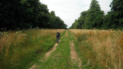
Then we embarked on a section of a wide avenue between trees called Duke's Ride which leads in the direction of Euston Park and Euston Hall the home of the Duke of Grafton. www.eustonhall.co.uk In 1666 Henry Bennet, later Earl of Arlington planted this avenue. http://list.historicengland.org.uk/resultsingle.aspx?uid=1000171
.
Still used by farm vehicles, sandy in parts, muddy in others it goes straight until you reach a point where you have to turn right where there is a distant view of the Hall and its grounds. After passing through a tree built it is west again and into the village of Euston.
This the war memorial and a green at an entrance to the Hall grounds.
A short section of the A1088 takes the Angles Way over the Black Bourn a tributary of the Little Ouse River.
The route is up Bury Lane another unsurfaced track. No sooner had I taken this photo of Jim ahead than a stag leapt out in front of him, ran down the track for 20 metres and then dived back in the undergrowth.
The route passes between fields crosses the Duke's Ride again and becomes the Euston Drove which leads all the way to Rymer Point on the A134. With no footway there is a dodgy section north along it for 400 metres to join another wide farm track heading west towards New Zealand cottages. A picnic lunch was taken on the track side.
After the cottages the track crosses a bridge of what is left of this disused railway track of the Thetford to Bury St Edmunds line that was opened in 1876, closed to passengers in 1953 and closed to all freight traffic in 1960. It was a 12.5 mile single track line. https://en.wikipedia.org/wiki/Thetford_to_Bury_St_Edmunds_line
The Angles Way continues north west. At a junction it was left south west towards a large forest and the junction with another track called the Elveden Road where it is right north west again along the edge of the forest.
The track then goes diagonally across two large fields, this is the first that had a healthy corn crop.
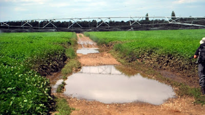
The second was a little more difficult. A potato crop was being automatically watered by this long mechanism that moved slowly cross the field. There was no way round we got a watering, fortunately it was a warm day!
At the other end of the field is a junction of tracks called Barrow's Corner which the Ordnance Survey Sheet indicates was on the line of the ancient Icknield Way although nothing can be seen on the ground. We left the Angles Way to walk along a track passing a pig farm and some cottages to the A1106 where we had left Jim's car.


No comments:
Post a Comment