LIPHOOK TO MIDHURST 12.75 MILES
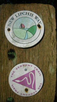
Introduction:- This walk has a dedicated web site http://www.newlipchisway.co.uk/ There is a downloadable leaflet on the walk where it is stated to be a 39 mile walk from Liphook in Hampshire to the sea at East Head at the entrance to Chichester Harbour. The route crosses the South Downs National Park. It goes via Woolbeding Common, Midhurst, Singleton, Chichester, and West Itchenor.What follows is a description of my journey along the route. To the left is one of the waymarks and they are fixed so that the word "Lipchis" is the direction of travel.
To get to the start take the train to Liphook, Hampshire. For those coming from afar there are no hotels near the station, those that are just out of town are in the wrong direction and will add to your walk on Day One unless you get a taxi there and back.
The figures in brackets are the Ordnance Survey Grid Reference and the cumulative mileage.
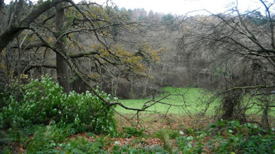
On exiting from the station go to the north east to locate the road that crosses the railway line nearby [841309 - 0.10 miles] and turn right south east along it. This is the Midhurst Road and continue along it passing the ends of the following roads on the right - Gunns Farm, Hollycombe Close, and South Road and then on reaching the urban edge there is a road on the left called Highfield Lane signposted to Highfield School. Go left along it (there is a small path that short cuts the very corner) and immediately look for a bridleway on the right. [847305 -0.55 miles ] Follow the track through woods (see photo below) until at 853303 [0.98 miles] and now within Access Land there is a path signposted to the left off the track. Follow it as it climbs and then levels out, then joins a vehicular track where the route is straight on.
At 855305 [1.12 miles] turn right along a vehicular track that goes through the wooded Stanley Common (see photo below).
Follow it until open fields appear ahead (861299 - 1.63 miles) here turn right keeping in the woods along a track heading south south west. At 859294 - 2.02 miles ignore a bridleway to the right and keep straight on. At 858292 - 2.11 miles the bridleway turns left and goes south east with the grounds of the Hollycombe Steam Collection on the right, a bit of the rail track and signals can be seen. The bridleway then starts a descent in a cutting (see photo below).
The route is dropping down into a valley surrounded by hills. The trees have a habit of falling across the route. This one has been reported to West Sussex County Council.
Near the bottom of the hill there is the view below north towards Marley Heights and in the far distance Black Down (see photo below)
Nearing the bottom of the hill (861287 - 2.52 miles) there is a cottage off to the right and then the bridleway passes to the side of some dwellings at Elmers Marsh before coming out onto a road. (863283 - 2.79 miles). Turn left along the road for about 40 metres and take a path on the right. The path runs along the side of electricity installations and then goes into Hartley Green Copse (865282 - 2.95 miles). Keep going in a straight line through the woods until at 867279 - 3.18 miles take the footpath to the left (signposted). At 869279 - 3.29 miles it crosses a forestry track and continues along another ahead where there was tree clearance on the left (see the picture below).
At 871279 - 3.44 miles turn right up a bridleway which emerges into field associated with Upper North Park Farm. The bridleway is fenced out of the fields. On approaching a substantial house on the left I spotted the unusual child's swing (below) on the path. (872277 - 3.61 miles)
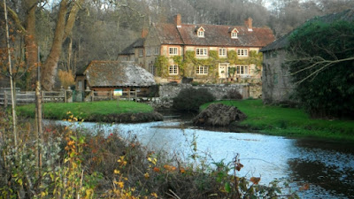
Immediately after was the lovely view below across a pond, complete with fountain, to the farm house a lovely mixture of different building materials. It is left on reaching the gates along the approach road.
The road drops into a valley crosses a stream and climbs up the other side. At the top where the road goes left the route is across a stile into a field. (874275 - 3.78 miles) Follow the edge of the field to the far right corner where there is another stile into the wooded valley on the right. 875274 - 3.90 miles). Continue along a path which keeps to the top of a slope down to a stream on the right. The path crosses the stream and then at 873269 - 4.22 miles where there is a track to the right the route enters a forested area. Continue ahead to a junction of tracks where there is a wooden observation tower. Continue straight on uphill until at 840266 - 4.40 miles the path enters a pine forest and there is a view back (see photo below).
At 873265 - 4.46 miles a cross roads of tracks is reached and here the route is to the right along a forest road gradually up hill through West Copse. The forest track levels out and even descends slightly, passes a track down to the right and at 899264 - 4.76 miles the woods are left behind and then there is a house on the right with a lovely view to the north. Follow the track until it reaches a road. Turn left uphill along it with banks on either side. On reaching the top of the gully look for a path on the right with a seat immediately down it. The view is quite amazing over Woolbeding Common (see below). the perfect picnic lunch spot. (869262 - 4.93 miles). http://www.nationaltrust.org.uk/woolbeding-countryside
If you take a detour on a path to the right (when sitting on the seat) and walk along the top of the slope there is a trig point and the wide view below. (867264)
The view from the aforementioned seat is the confluence of the Serpent Trail and the New Lipchis Way which briefly follow the same route. Below are the two waymarks.
There is a car park to the south of the seat, follow the road and it is on the left at 5.06 miles 869260. Turn left into the car park and out the other side climbing a path east through the common. At the top of the ridge the path comes out onto a vehicular track [5.20 miles 871260]. Turn right along it. The Serpent Trail goes off down a path to the left. At 5.55 miles 875256 just after a parking area turn right along a path going west across the common. A cross roads of tracks is reached at 5.78 miles 871254. Continue straight on with fields now on the left. The path drops down to a track at 5.94 miles 869254, turn left here and on reaching farm buildings right then keep straight on near a little cottage until a road is reached at 6.13 miles 866253. This is the road you left at the earlier car park. Go straight across to a path on the other side going west downhill until Linch Road is reached at 6.26 miles 864253. Bear left and go through a parking area on the other side of the road and along another path south west. Lower down ignore the attractive path off to the right that figures in the photo below.
At 6.42 miles 862252 there is a cross roads of paths, go straight on. Paths join from the right and then the left and at 6.57 miles 861250 bear left down a vehicular track which leads past Woolhouse Farm which is down on the right. The gypsy wagon below was outside when I passed at 6.62 miles 861249. Follow the track around to the left in the picture below to the left of the wagon.
There is a valley with rough cow pasture on the right of the track which now bends to the right. At 6.78 miles 862247 turn right down a track which keeps within woods but with those fields still on the right. At 7.07 miles 859245 there is a lake down in the woods below, it is the dark area in the trees on the other side of the field in the picture below.
Keep following the track which is pictured below, looking back at 7.28 miles 857242.
At 7.41 miles 857240 leave the track on a path on the right which descends steeply with a cottage below, the path leads to the entrance. [7.48 miles 856240]. Turn left on the access road following a stream on the right. Immediately after the entrance for Ash House [7.55 miles 856239] fork right off the roadway onto a path which immediately bears left staying inside the woods with a field and a stream down to the right. At 7.85 miles 855234 the path reaches a road (Stedham Lane) turn right along it over the stream and then immediately left along a path that keeps above the stream. The stream is going soon to join the River Rother. The path is enclosed to start with and then unenclosed in the second field. You should be able to exit the field in the far left corner onto a track near the River Rother [8.08 miles 855231]but it was buried in the undergrowth when I visited. Follow the track to the right which heads towards Iping and its church visible ahead. At 8.24 miles 852229 the track joins a road with St Mary's Church opposite - see photo below. https://en.wikipedia.org/wiki/Iping
Go left downhill to cross the River Rother. Below is a picture from the east side. https://en.wikipedia.org/wiki/River_Rother,_West_Sussex
Following the road on the other side look for a path on the left going uphill at 8.36 miles 853228. The path passes by the side of a house and then starts along an enclosed section through fields, the River is way off to the left or north. At 8.70 miles 858226 the path rejoins the River Rother and follows it until Stedham Bridge comes into view at 8.99 miles 862226.
Cross the bridge and follow the road until the buildings on the right have been passed and turn right of the road into a field at 9.10 miles 861227. Bear around to the right back to the riverside and on the opposite bank there is the view in the photo below of Stedham Hall.
Follow the river bank until at 9.56 miles 863232 there is the view below of Stedham Mill.
Ignore the path to the right across the weir to the mill in the picture below and the one to the left which climbs up to Stedham Lane and continue to follow the river.
The path continues by the river crossing a footbridge and eventually leads into a field. Bear around left following the side on the left. It appears to lead to a field gate and an exit onto a lane, [10.54 miles 870222] but here go right keeping in the field and following the boundary on the left until there is an exit onto the lane near Woolbeding Bridge in the picture below at 10.72 miles 872220.
Cross the narrow medieval bridge and turn left down a path that follows the river. At 10.82 miles 873220 the path bears right away from the river. Ignore a path on the left and continue to a cross roads of paths, that to the left and the right marked as the Rother Valley Walk. Take this permissive path on the left [10.88 miles 874219] and follow the track across the field towards woods ahead. The track and the cross roads is shown in the photo below, the woods are in the background.
There is also a view across the river to Woolbeding House and All Hallows Church. https://en.wikipedia.org/wiki/Woolbeding
For other accommodation options see www.booking.com or http://www.smoothhound.co.uk/
For some history of Midhurst and details of what it has to offer see https://en.wikipedia.org/wiki/Midhurst


No comments:
Post a Comment