Snowdon Range

Snowdon Range
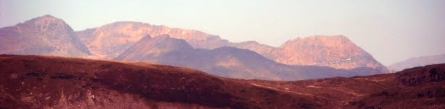
Snowdon Range from Moelwyn Mawr

Wednesday, 25 March 2015

CORINIUM TO AQUAE SULIS DAY FOUR

CIRENCESTER TO BATH MAINLY ON THE FOSSE WAY

19TH MARCH 2015 GRITTLETON TO BATHEASTON


After a good breakfast it was out into the cold and overcast day and the morning was more like we should have expected in March. We went back across the three fields to the Fosse Way, the one that was cropped soaking our boots for the first time this holiday.

There was only a mile of unsurfaced Fosse Way and then there was eight miles of the Fosse Way as a modern road although mainly with little vehicular traffic. This is where we joined the road just before the underpass under the M4. 

A quarter of a mile later we passed the Salutation Inn all shut up as it was far too early, there would not be another pub until Batheaston.

The road descended down a valley to cross the By Brook by the Fosse Bridge after 2.8 miles. Most of the water was being diverted into a mill stream just before the bridge.

On climbing out of the valley we diverted off the Fosse Way to look at Lugbury Long Barrow. It is 180 x 90 feet but only 6 feet high because of ploughing damage.

19th century excavations revealed three chambers with burials of 28 adults and children. At the eastern end there must have been a formal or false entrance as there are to vertical entrance stones and one that looked as though it was balanced on top but had slipped.

After 1.5 miles we next descended to the Broadmead Brook where there was another Roman settlement and a Temple of Apollo. We followed a bridleway along the valley to a clearing in a wood where we had a break.
 
 This is the valley and in the distance the bridge on the Fosse Way but we could not locate anything we could identify and returned to the Fosse Way. Pity there was not a display board!
There was a long climb out of the valley, a short dip into another and then at The Shoe we stopped on a  bank for our picnic lunch. Shortly after we arrived at The Shoe, the pub became a house a long time ago. The sun was making an appearance. The Fosse Way descended into the pretty valley of Doncombe Brook and the descent makes one wonder what sort of braking system Roman vehicles used. At the bottom by the brook and a road junction is this pill box.

On climbing out of the valley the huge active military Colerne Airfield was on the left and at the other end we passed the end of a huge runway. A busier road joined from the left which made progress more difficult, hoping on and off the verge.

After a quarter of a mile we got to the Three Shires Stone down off the road on the right marking where Gloucestershire, Somerset and Wiltshire meet. They were erected in 1736 and repositioned in 1859 and are a folly despite their megalithic appearance.

Apparently on digging a hole for the Gloucestershire stone three skeletons and a James II coin were found.
 
 
Another mile and we finally got off the road onto Banner Down where the Fosse Way deviates from the modern road and we began a 160 metre decent to the River Avon.

By now my legs were beginning to complain, the pounding along the road was taking its toll. With great pleasure we diverted into the George and Dragon at Batheaston to get two pints of ale and a rest as we had not really stopped all day.
 

Rejuvenated it was half a mile along a flat path by the River Avon to the Old Mill Hotel next to the Toll Bridge. www.oldmillbath.co.uk In the evening we walked to the George Inn by the Kennet and Avon Canal for a meal.
 
It was a 12.80 mile day

Tuesday, 24 March 2015

CORINIUM TO AQUAE SULIS DAY THREE

CIRENCESTER TO BATH MAINLY ON THE FOSSE WAY

18 MARCH 2015 - CRUDWELL TO GRITTLETON

The day started sunny and kept that way all day - magnificent walking weather for March.
We retraced our steps along the footpath through Crudwell and Chedglow, successfully avoiding getting electrocuted this time and got back on the Fosse Way.
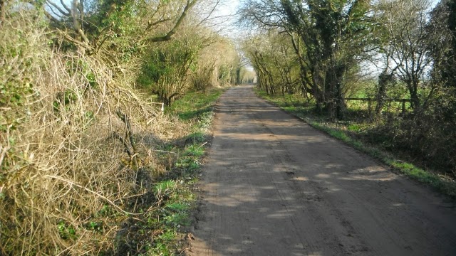
The going was good today mainly on a Fosse Way looking like this section at the beginning.

This is Ashley Marsh Covert, a private wood, off to the right going south. There is nothing to be seen but there was a Romano British Settlement there and apparently sandstone roofing tile fragments are numerous in the ploughed soil. 

The Fosse Way runs to the west of the former Long Newton airfield now largely restored to agriculture.

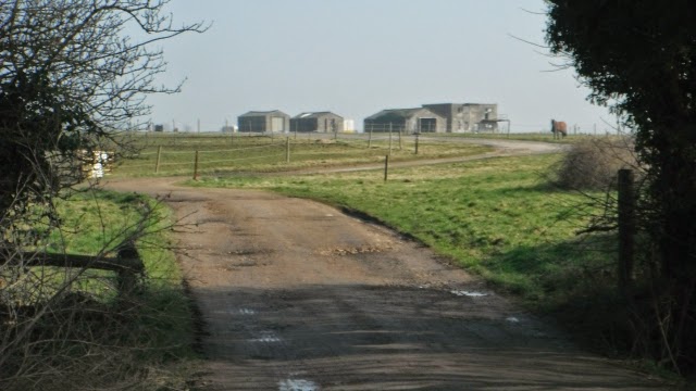
A glimpse through an entrance way into the former airfield and there were a number of buildings that could date from World War II.

Before the B4014 there is this prefabricated pill box on the east side of the Fosse Way and another to the west of the route in a field.

This is the ford on the Fosse Way where vehicle users cross the Tetbury Branch of the River Avon.

 Fortunately pedestrians have the old footbridge next to it to get across.

At Whitewalls there is another earthwork in a wood believed to be of Roman origin. Between the wood and the Fosse Way is an industrial estate and although it is not advertised my old guide book told me it used to be a prisoner of war camp and in one of the old prefabricated buildings built to house them Italian prisoners had created a chapel and decorated it. These pictures are of the ceiling. Thanks to the occupier who was using it as a workshop for letting me in and showing me around.


 As you descend from Whitewalls to the Sherston Branch of the River Avon there is the site of a Roman settlement on both sides of the track shown above.
At the bottom there is this lovely bridge and a spot where we had a picnic lunch next to the river. There are also some display boards relating the archaeological significance of this site.

Having climbed out of the valley the photos above and below show the next pretty section.

The route then becomes a tarmac road through fields.

 On the way the road crosses a railway and passes Fosse Lodge with an interesting tower feature.
At Dunley the Fosse Way returns to being a rough vehicular track. South of Brimsol Spring we took the footpath south east across three fields to Grittleton to stay at the Neeld Arms www.neeldarms.co.uk located in The Street just east of the church. Excellent food, exceptionally well patronised for a Wednesday, rooms well appointed but the floor boards creaked.
 
A 12.8 mile day.

Monday, 23 March 2015

CORINIUM TO AQUAE SULIS DAY TWO

CIRENCESTER TO BATH MAINLY ON THE FOSSE WAY

17TH MARCH 2015 - CIRENCESTER TO CRUDWELL


It was up early and a full English Breakfast and then into the town to get some picnic materials for lunch on days three and four.  The misty start was already giving way to week sunshine and the predictions for a good day encouraged us to start.

We left Cirencester via Querns Lane the Roman Via Principalis to visit the Roman amphitheatre on the south western edge of the town. This is an artists impression that is on display in the Corinium Museum and it had a seating capacity of 8,000.

The reality of what remains impresses, this is the approach from the road.

This is the centre with Dave giving some scale.

We started out on the A429 and the first section has a footway. This in the one mile marker.


We left the road, because the next few miles would be suicidal for pedestrians and followed the Monarch's Way http://www.monarchsway.50megs.com/ across the grounds of the Royal Agricultural University http://www.rau.ac.uk/


We also passed some waymarks for the Palladium Way http://www.ldwa.org.uk/ldp/members/show_publication.php?publication_id=9046 This is Ashwell Pool reached after 3.61 miles.

This is the view towards Bledisloe House from the path

These snowdrops are located on the outer edge of Trewsbury Camp Hill Fort http://www.british-history.ac.uk/rchme/ancient-glos/p32 

On reaching the remains of the Thames and Severn Canal we diverted to have a look at the source of the River Thames. As is normal some stones where water gushes out occasionally marks the spot as does the wording on the marker stone behind it but there was no water to be seen despite it being March.

The next section was along the towpath of the Thames and Severn Canal which is part of the Thames and Severn Way and also the Wysis Way from Monmouth, one Dave and I have already done. This section is dry and could only be navigable if the former pumping stations could be activated to bring enough water to the surface. See www.cotswoldcanals.com

The towpath went under a bridge carrying a railway.

The Coates Round House. Photograph taken into the now glorious sunshine.

Tarlton Bridge carries the road between Tarlton and Coates and the towpath goes underneath.

This was the start of a short section where there was water in the canal.

This is the Coates Portal to the two-mile long Sapperton Tunnel where there has been a collapse of the roof, it is the fourth longest tunnel in Britain.

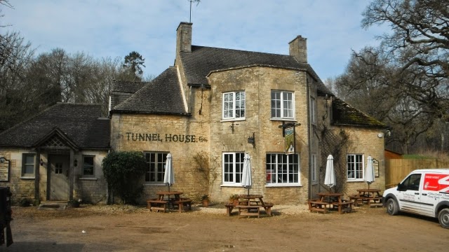
Lunch was taken after six miles at the nearby Tunnel House Inn and we were lucky enough to get our order in before a large party of ramblers arrived after their morning walk. www.tunnelhouse.com

Then it was on via Tarlton to Rodmarton where we paused on the seat just in the picture and explored the Church of St Matthew. http://en.wikipedia.org/wiki/Rodmarton
 

After that it was down a lane to cross the A433 onto the unsurfaced Stonehill Lane. We did stop to look at the disused railway line and the site of Rodmarton Halt but it was overgrown. The Lane continued across open fields to the Fosse Way to the South West of Kemble Airfield.  

This is what we had come for, the relatively undamaged section of the Fosse Way.

We continued passing Fosse Gate and Ash Bed until we diverted off it along the path that led through Chedglow to Crudwell which was 1.61 miles off the Fosse Way.

Just before Chedglow we saw this huge field full of hundreds of chickens.

At West Crudwell we came across this unpleasant structure an electrified fence too high to step over and with no way of disconnecting it. I got a belt from it and took a step back. Using my insulated walking stick handle I managed to push it down. Not far enough as Dave got hooked up in it fell over and got several belts before extricating himself from it. It is being reported.
 
We continued to the Best Western Mayfield House Hotel in Crudwell for our overnight stay. www.mayfieldhousehotel.co.uk  We walked SW down the A429 to the Wheatsheaf Inn for our evening meal although there is another pub the Potting Shed  to the NE where we sampled some ale after the walk.
 
It was a 14-mile day.


Sunday, 22 March 2015

CORINIUM TO AQUAE SULIS DAY ONE

CIRENCESTER TO BATH MAINLY ALONG THE FOSSE WAY

16 MARCH 2015 EXPLORING CIRENCESTER


On this trip I was accompanied by Dave Bond and we set out to explore the Cotswolds taking in most of the Fosse Way which has not been upgraded to a major road. It runs from Lincoln to Topsham near Exeter and was one of the main arteries of the Roman Empire. At Cirencester was the junction with Ermin Street which runs from Gloucester to Silchester.

To get to Cirencester there is an hourly bus service from Swindon Bus Station  which is five minutes walk from the Railway Station. It is the 51 from Bay 16 and after 56 minutes arrives at the Corn Hall in Market Place.

This is the church  of  St John the Baptist opposite the bus stop. We arrived at lunch time and after and intake of ale and food at the Fleece in Market Place went to the most superb Corinium Museum www.coriniummuseum.org which takes one through the evolution of Cirencester with many fantastic exhibits well presented and it takes a good two hours to do it justice. For £5 there is a booklet of its highlights which is well worth buying as you go in so that you do not miss the small as well as the large exhibits.

 
Very realistic figures illustrate the different archaeological periods

 
The main focus is on the Roman Period and the finds locally and considering only 1% of the town has been excavated one can only imaging what may yet be uncovered.

Mosaic manufacture was one of the things Corinium was famous for during the Roman period and some are displayed vertically as above.

There is a recreation of a Roman garden.

A simulation of a Roman room with mosaic. The figures looked as though they were watching a TV on the wall.

A big panel gives an impression of what the Roman town would have looked like, and it was the second largest in the country behind London

As it is on two levels one can enjoy some of the mosaics from above 

There are sections devoted to the Anglo Saxon and Medieval periods as well as the 18th and 19th centuries. 

Because of its location Cirencester was fought over during the Civil War and 1643 brought destruction, death, an economic collapse and starvation.
 
We stayed at the Old Brewhouse, 7 London Road, Cirencester GL7 2PU an excellent B&B full of objects of interest in the house and the garden at the rear off which are a number of rooms. http://www.theoldbrewhouse.com/