Snowdon Range

Snowdon Range
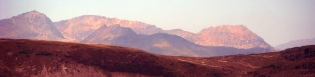
Snowdon Range from Moelwyn Mawr

Sunday, 23 August 2015

THREE SAINT'S WAY - DAY THREE

COSQUEVILLE TO BARFLEUR 10.61 MILES


A flat day on a wild coastline was in prospect as we left the hotel in Hameau Remond. It was right out of the hotel yard and north back to the coast along the Route du Vicq passing through the adjoining settlement of Hameau Denneret. After 0.38 miles the sea and a car park was reached at the Plage du Vicq and the road bent right to follow the coast. After passing between some houses and the coast the road bent down right and came to an end at 0.55 miles. From here there was a clear path along the inside of the dunes pIled up against the shoreline. More boots full of sand and harder going. Progress along the coast was monitored on the maps by reference to the little rocky headlands and the car parks that were at the end of roads leading to the coast. Inland there were lots of low quality saline grazing fields some with bogs, marshes and lakes within them. On the shoreline were the remains of German wartime installations. The shore itself was long stretches of soft golden sand punctuated by rocky areas stretching into the sea. The plants on this unstable shoreline were only those that could withstand this harsh saline environment.  Le Hable was the first such marshy lake on our right and we progressed to the first sandy car park at the end of a track from the village of Renouville inland at 1.21 miles.

At 1.51 and 1.53 miles two tracks come to the shore from Renouville the second one called Les Mares being a tarmac road ending in a car park. The next section had a large marshy lake called La Mare on the right, a protected area. Ahead given good visibility we were able to see two lighthouses, one tall one and one short one which are on our route and enabled us to monitor progress. There were then a number of rough vehicular tracks adjacent to the shore and at 2.66 miles a collection of concrete blockhouses. At 2.87 and at 2.98 miles two tracks came to the shore from the village of Rethoville inland. The second of these tracks was called Les Haysettes and on reaching the shore turned east to follow the shore and we followed it as it was easier going. After another rough car park at 3.35 miles the next attraction was a significant collection of blockhouses on the Pointe de Neville at 3.84 miles.

The track we had been following turned inland after the blockhouses and we turned off it to follow another path running behind the sand dunes at 3.96 miles. At 4.18 miles another road coming to the shore was reached and we followed it as it went east along the shore. At 4.48 miles another track came to the shoreline and we continued to follow the one along the coast. At 4.86 miles another road came to the shore this one called Le Bas de la Rue from the village of the same name inland. A no entry sign forbids vehicles going east from here but the track continued. At 5.18 miles the track joined another coming from Le Bas de la Rue and we turned left along it still following the coast this time with a 21 hectare lake called Etang de Gattemare on our right. http://www.conservatoire-du-littoral.fr/siteLittoral/127/28-etang-de-gattemare-50_manche.htm

At 6.00 miles having traversed the length of the lake next to the sandy beach we reached a road where we decided to depart from the coast and head inland to the village of Gatteville Phare in search of lunch. At 6.13 miles in the hamlet of La Hougue we turned right at a T-junction along the Rue de la Hougue, at 6.27 miles turned left along the Rue de la Houguette and at 6.60 miles we arrived at the Place de Notre Dame in the centre of Gatteville-le-Phare by the church. We equipped ourselves with what we needed for a picnic lunch from the Boulangerie and went and sat in the seats by the church. On the square is the old, simple and attractive La Chapelle des Marins de Gatteville-le-Phare which we visited before leaving towards the lighthouse. http://www.ex-voto-marins.net/pages/lieupage50Gatteville.htm

We left the square northwards along the D10 signposted to Le Phare. At 6.74 miles at the next right hand bend we left it to continue straight on down a minor road called Chemin de Roubary. Passing a number of gun sites and block houses the track led at 7.06 miles to a T-junction with the Chemin de Gattemare where we turned right and at 7.10 miles at another T-junction with the D10 again we turned left. We soon had a lovely view over the harbour of Roubary with the boats bobbing about on their moorings.

At 7.19 miles we left the road to follow a path that took us out to the end of the harbour and around a point called Le Couperon and back on to the D10 again at 7.47 miles. We followed the road around a rocky shoreline towards the lighthouses ahead. This would be an exciting place to be in rough weather as there were plenty of rocks off shore. At 7.93 miles we reached the causeway that led to the lighthouses which were too spectacular not to visit.

Strong currents off the tip of Barfleur, and many shipwrecks (the most famous of which is probably that of the White Ship) made it essential to build a lighthouse. In 1774, during the reign of Louis XVI, the Rouen Chamber of Commerce decided to build a first lighthouse in granite, 25 metres high. At its top fire wood and coal burned continuously. In 1780 a coal fire was replaced by a system of lamps consists of 16 oil lamps in a glass lantern. That is the one on the left in the above picture. This lighthouse was too small to receive modern lenses, and too low to be heightened by 32 metres, so it was decided to erect a new tower in 1825. The architect Charles Felix Morice de la Rue, in the reign of Charles X drew designs and plans for the tallest lighthouse of the time (since surpassed by the one on Virgin Island).  The centre stone was laid on and work continued into 1835. On the 1 it was lit for the first time. The old lighthouse became a semaphore.
My translation of part of https://fr.wikipedia.org/wiki/Phare_de_Gatteville


The 1774 lighthouse from the viewing gallery at the top of the later one.

The view south towards Barfleur.

The view west the way we had come along the coast.
 
There is a little museum near the bottom of the later lighthouse and it was open and here we bought tickets to climb the lighthouse. At a height of 74.85 metres and with 365 steps up a spiral staircase it is not for the faint hearted. When I returned to the museum the custodian unkindly remarked that I needed to lose weight!
 
So it was back down the causeway and at 8.23 miles it was left and along a track barred to vehicles following the coast south. The shore was rocky with occasional patches of sand. At 8.69 miles we reached the other end of the track that was barred to vehicles and joined a road called La Saline which took us along the landward side of the premises of SATMAR. http://www.satmar.fr/uk/home/
The SATMAR operation based in Gatteville is involved in oyster spat production. The premises include a hatchery, a micronursery and a nursery. The road gives good views of the salt water lagoons. Once past this establishment the road returns to the rocky coastline. The Moulin de Crabec comes into view at the end of a creek. At 9.42 miles where the road veers to the right a path continues towards the mill and crosses a bridge over the end of the creek and on to a rough vehicular track at 9.47 miles. Here we turned left along the track called Chemin de la Masse which kept close to the coast but went the landward side of several properties. It ended at a beach at 9.74 miles where it continued as a shoreline footpath. At 9.85 miles at a car park it continued as a road with views of Barfleur and its prominent church ahead at the other end of a bay. At 10.08 miles where vehicles have to go right we continued along the coast road towards the old town ahead. Where the road went right we followed a path along the top of a sea wall heading for the church. On reaching the wall surrounding the churchyard we went clockwise around the 17th  century Church of St Nicholas and by the side of the old fort that guarded the entrance to the harbour. The church is a solid but austere building and below is a poor photo of the inside.


Several centuries ago Barfleur was the largest port in Normandy, and has seen several important historical events. It was here in 1066 that the Normans prepared for the Battle of Hastings, while late in the night of 25th November 1120 at Barfleur the ship carrying Prince William to England struck a rock that caused the death of the heir to the English throne and chaos in the monarchy.
The town was burned by Edward III in 1348 and then again during the 15th and 16th centuries. In 1692 it was just off the coast from here that a great ship battle took place, known as the Battle of Barfleur. Extract from  http://www.francethisway.com/places/barfleur.php At 10.31 miles we arrived at a slipway where there is a plaque on a large rock marking the departure of the 1066 invasion of England.
 

We continued along the quay looking down into the fishing boats which come in and sell their catch at the port.


The Café de France is amongst the buildings facing the quay and has a lovely set of tables outside with a perfect view of the harbour. We stopped for drinks and a light and late lunch and were to return here in the evening for some quite superb food, fish being a speciality. The harbour is quite large and it is flanked by large granite built houses, shops and cafes.


It was 10.56 miles before we reached the end of the Quai Henry Chardon and turned right away from it down the D1 the main road out of town towards Cherbourg. A little way down the road, where all the main commercial premises are located, was the Hotel Le Conquerant, 18 Rue Saint-Thomas, 50760 Barfleur +33 2 33 54 00 82 www.hotel-leconquerant.com The distance for today was 10.61 miles, but only 195 feet of climbing (excluding the lighthouse) and 3 hours 30 minutes of actual walking time.


There appeared to be no one at home in the hotel, those that were there were engaged away from the front elevation. There was a balcony at second floor level and when my colleague Peter jokingly rendered "Where for art though Romeo" the balcony doors opened and a chambermaid appeared much to our amusement. The hotel is very up market and well appointed and pricy but it was nice to have a bit of luxury. Hidden at the back is a lovely garden in the photo above.


Saturday, 22 August 2015

THREE SAINT'S WAY - DAY TWO

CHERBOURG TO COSQUEVILLE -14.51 MILES

You could get a bus to the outer edges of Cherbourg if you wanted to avoid the urban area. Bus No 8 goes to Tourlaville Becquet - see the interactive route map and timetables at http://www.zephirbus.com but we came here to walk. All the distances quoted are from the start and with the description below you should be able to follow. A GPS would be useful so that you can monitor to the distance travelled as well.

Starting at the statue of Napoleon we walked back towards the dock basins passing the Basilique Sainte-Trinite and the dry dock and along the Quai Caligny and across the lock that connects the inner and outer basins and back along the east side of the outer basin along the Quai General Lawton Collins to a roundabout. Following a cycleway the route then was towards the Ferry terminal following their fencing along Boulevard Felix Amiot. The terminal prevents any pedestrian route along that part of the coast. After 1.25 miles we pass the terminal building and where the road forked we went right along the Boulevard Maritime (the old road) in the same direction. Where it bends right to a T-junction after 1.95 miles we went right and then immediately left along a cycleway which goes through to the Boulevard des Flamands and continues along the north side of it. When the fencing on the left ended there was a car park and that was where we turned left through it and under the E3 (the main road out of Cherbourg) to get our first glimpse of the coast after 2.53 miles.

Piles of stones on the beach protected the coast road with the E3 on the right. At 2.82 miles there was a roundabout on the E3 to the right and a link from it to the minor coast road the Boulevard de Collignon. After passing the Rue de la Mer on the right at 3.21 miles a beach car park was reached. We followed a narrow path on the left going parallel with and next to the coast with more parking on the right. To our joy a beach bar was seen on the edge of sand dunes our first stop. The beach promenade along the Plage Collignon led us to Le Becquet at 3.97 miles. After passing seaward of an industrial property on a narrow path we walked along the Chemin de Viviers next to the sea to the Port du Becquet a tidal narrow harbour protected by a sea wall but as the tide was out it was a sea of mud. At the end of the quay on the right in a green space were two white lighthouses marking the route into the harbour entrance. A narrow road called La Roche Toinette continues following the coast and after a left fork becomes a path around a little headland at 4.50 miles. Here we had to head inland on a narrow road called Les Tamiris because of a lack of access to the next section of coast. We soon emerged on the main coast road the Route de Denneville where we went left along a narrow footway crossing to the other side when it ran out. After climbing up a hill we picked up the route of a former railway line on the left at 4.74 miles which gives the impression of being a cycleway but is open to vehicles called La Houguette des Bas. A few hundred metres separate this route from the sea. At 5.11 miles we turned left down the first narrow road called the Chemin du Moulin which leads to the sea. At the bottom a narrow path went right by the sea and then climbed up the Chemin de la Cale to join a wider but still narrow road where we turned left along it. Again keeping a little away from the coast, later keeping inland of a large holiday camp on the Pointe du Heu we arrived back on the main coast road at the Plage de Bretteville at 5.54 miles.

Keeping to the main coast road and having left the beach behind we reached a car park on the left. Just beyond it on the left  at 5.74 miles is the first of a series of useful coast path signs giving the distances to the next feature. Here we turned left to follow the path to the shore and turned right following the coast. The scenery was getting wilder now. There is a headland visible ahead but before reaching there we had an unexpected challenge. The main coast road (the D116) is set back from the coast and the strip of land between it and the coast is divided into lots of little fields. Nearly every point where the hedge or fence reaches the coast involved climbing a stone stile. I lost count of the stiles and welcomed the point where the coast path finally climbed back to the coast road at 7.10 miles as it started to work around the headland. The route involved turning left and following the crash barrier on the coast side of the road until the road starts to go into a cutting. At the point the crash barrier came to an end before the cutting we turned left to follow a path which was going to take us out to the end of the headland called the Pointe du Brick. It is downhill to the point and then back up again after that through wartime remains. The path descends down a steep set of steps back to the coast road at the other end of the road cutting. Ahead was a lovely beach called Anse du Brick which was below us as we walked along the coast road in search of a lunch spot. At 7.60 miles on a side road off to the right was a camp site where there was a shop with what we needed.

Returning back to the coast road we went straight across and down a side road that led to the beach, across the outfall of the Ruisseau du Nid du Corps and onto a coast path running between dwellings and the cliffs until at 8.09 miles we were out onto open coastal heathland with the coast road well above us. A nice wild section of coast path followed around a gradual bend to the right (the Pointe du Brule) and then above the Anse du Pied Sablon a sandy cove. The path joins a narrow vehicular track briefly at 8.83 miles before leaving the track again as it goes inland. The path took us next to the pretty Port du Cap Levi at 9.27 miles. A couple of sea walls keep the big waves out of this tidal port with a small number of boats sheltering and bobbing about. The route joined and followed a road around the port and climbed out of the bay with it and just beyond the first house on the right we took the coast path on the left towards a headland where Fort du Cap Levi is located. http://fortducaplevi.com Built in 1801 at the instigation of Napoleon to protect the Cherbourg Bay  there are display boards explaining its history which we studied with interest. https://fr.wikipedia.org/wiki/Fort_du_Cap_L%C3%A9vi At 9.80 miles on the other side of the fort we re-joined the coast path and headed to the headland Cap Levi where there is a lighthouse https://fr.wikipedia.org/wiki/Cap_L%C3%A9vi The nineteenth century version was destroyed in 1944, the current 36 metre high structure was built in 1947.

There is a car park at the headland at 10.32 miles from which the coast path continues along a rocky coastline. The path goes through a quarried area and then reaches Port Pignot a tiny tidal port with room for only a dozen boats at 10.88 miles.  Leaving it along the road which accesses the port we followed the coast around a slight headland where we briefly left the road to follow the coast and then the sandy Plage de la Mondree was ahead. After rejoining the road we reached a car park serving the beach at 11.28 miles. We found a path on the landward side of the dunes piled up against the beach which took as around the bay. Boots full of sand we arrived at the car park at the other end of the beach at 11.89 miles. We took a vehicular track that followed the coast out to the next headland at Freval. Here there is a cross and monument. Prometheus was a French submarine of 1500 tons launched in 1930 in Cherbourg. As it navigated the surface during trials, the submarine suddenly sank off of Cape Levi for no apparent reason, causing the death of 62 of its 69 crewmen and causing great excitement in France. The wreckage was located the following day but attempts to salvage and re-float it  were unsuccessful.  The testimonies of survivors revealed that the sinking was likely caused by a sudden opening of dive purges.


The coast path continued to the next little headland where Fort Joret was located where there are a few houses. As we went around the headland we joined a minor road. Dwellings block the coast for walkers so we followed the road inland and turned left down the first vehicular track to the next bay at 12.73 miles. One more small headland, the Pointe de la Loge to go before we could think about getting to our accommodation, and it was another path through sand dunes adjacent to a beach. More dwellings and beach huts on the headland and another car park at 13.38 miles, beyond which was another coast road which we followed inland to a village called Hameau de la Mer. The stone built properties not only look attractive but clearly are designed to withstand the coastal weather. Where the road went right at 13.73 miles we went straight on initially along a vehicular track and then along an ancient path called Chasse Vauville, the stone walls on either side testimony to the track's age. It took us to Hameau Monnaie another collection of houses where we turned left along the road through the village at 13.99 miles. Keeping straight on we left the hamlet and the road turned to a farm track and at 14.35 miles we reached a T-junction and turned left. Two hundred metres later and at another junction our hotel was visible to the left. After 14.51 miles, 745 feet of climbing and 5 hours of walking (excluding stops) it was a welcome sight.

We stayed at the Hotel Restaurant Au Bouqet de Cosqueville, 38 Le Hameau Remond, 50330 Cosqueville. Tél. : 02 33 54 32 81  Email aubouquet.decosqueville@orange.fr  It is only a small hotel and there is no other on this coast so if you are following in our footsteps book early. The evening meal was outstanding. The chef was not into being hurried and each course was a masterpiece as well as the aperitifs. It took nearly two and a half hours, the tables were well laid out and we (four of us) were pleased as we staggered off to bed. The rooms were good and priced correctly.  As they say a good day was had by all. A picture of the hotel is below.


Friday, 21 August 2015

THREE SAINT'S WAY - DAY ONE

CHERBOURG TO MONT SAINT-MICHEL

DAY ONE  GETTING TO CHERBOURG-OCTEVILLE

The Three Saint's Way - First I ought to explain what this walk is, before reporting on my journey along it. Those seeking the route will need to acquire Volume One of Two of books by Paul Chinn and Babette Gallard from Pilgrimage Publications http://pilgrimagepublications.com Both volumes cover the route from Winchester to St Jean d'Angely which would be undertaken normally by someone seeking to walk from England to Santiago de Compostela in Spain. At St Jean d'Angely the walker would join the French walking from Paris and from there on French and Spanish guidebooks would be needed. As you can see this series of posts on Blogger is going to relate to just one small section, that necessary to make a pilgrimage to Mont Saint-Michel.
 
The route in England - This is Hampshire County Council's effort called the Pilgrim's Trail and goes from Winchester to Portsmouth. http://www3.hants.gov.uk/longdistance/pilgrims-trail.htm They have there own guide which would be a useful supplement. The ferries from Portsmouth to Cherbourg ( www.brittany-ferries.co.uk ) only run in the summer so if you do this walk you will need to check how you are going to make the Channel crossing. It is possible to go via Caen when there is no ferry to Cherbourg and get the shuttle bus to the SNCF station in Caen and then get a train to Cherbourg. Otherwise you will need to get the train from Portsmouth to Poole and get the ferry from there to Cherbourg. The early departure from Poole necessitates being within walking distance of the ferry terminal the night before.
 
Cherbourg-Octeville (to give it the correct name) is a small port with an old town well worth exploring so allow at least half a day. After exiting the terminal building there is a pedestrian route on the right which will take you in the direction of town, otherwise you will need to use the shuttle bus which takes you not to the town but the other end of the path. It would have been much more sensible for it to go to the bus and railway station which are next to each other. Ensure you have a plan of the town before you leave the ferry terminal. See also http://www.brittany-ferries.co.uk/guides/france/normandy/cherbourg
 
Place to stay - I chose the Hotel Napoleon, 14 Place de la Republique, 50100 Cherbourg-Octeville +33 2 33 93 32 32 www.hotel-napoleon.fr an elegant townhouse offering unfussy, contemporary rooms with Wi-Fi on a nice square on the edge of the old town and near the gardens on the waterfront. 
 
Place to eat - There are plenty of opportunities to get a good feed at a reasonable price and because of the cultural diversity every nationality and taste is catered for and whilst exploring the old town keep an eye out for one that suits you.

Place to visit - For an introduction to the town see https://en.wikipedia.org/wiki/Cherbourg-Octeville One place well hidden away is The Museum Emmanuel-Liais one devoted to natural history, archaeology and ethnography and located in a park surrounded by walls whose address is 19 Rue Bonhomme, 50100 Cherbourg-Octeville see www.ville-cherbourg.fr In 1900, Emmanuel Liais, astronomer, explorer, hydrograph and meteorologist, former director of the astronomical observatory of Rio de Janeiro bequeathed his goods to Cherbourg, where he had been mayor for 10 years and this included his house and the botanical park.
 
Maps - The Guidebook mentioned above does not cover the first section from Cherbourg to Barfleur suggesting instead you take the bus there. This is a pity because I will illustrate there is much to enjoy if you travel east along the coast paths. So you will need some maps. French digital mapping can be obtained from www.anquet.com and digital and paper mapping from the producers IGN http://espaceloisirs.ign.fr/boutique/top-25-et-serie-bleue.html The Topo-guide FFRandonnée 200 - Tour du Cotentin available from https://www.ffrandonnee.fr/boutique/topo-guide.aspx?ref=200 contains all you need to get to Barfleur and would be useful on other sections too.
 
The outer harbour and marina - Cherbourg-Octeville

Quai Caligny

Hotel Napoleon

Statue of Napoleon in the Place Napoleon

Basilique Sainte-Trinité

Dry dock off the outer harbour
 

Outer harbour

Bars and cafes in the Rue de la Paix

Emmanuel-Liais Park


Sunday, 26 July 2015

ANGLES WAY JULY 2015 - DAY NINE

BARROW'S CORNER TO THETFORD

Summary - There was only 7 miles left to do so after an early start we were back in Thetford for lunch. This last section was also part of the St Edmund Way and mainly ancient track ways to start with and finishing across Barnhamcross Common.

Because we only had four miles to drive to the start of the walk we were started on the Angles Way before nine in the morning. After parking near the B1106 it was back along yesterdays track passing the cottages and the pig farm to Barrow's Corner. There had been thunderstorms overnight so there were large puddles to avoid. The route in to Thetford was also part of the St Edmund Way and once again it was farm tracks with fields to the right and Albemarle Plantation on the left followed by Sandgault Plantation after that.

There were footprints of deer in the mud but we did not see any.

After crossing the Elveden Road the track continued with rough grassland on the right and Marmansgrave Wood on the left within which there was a herd of black sheep wet and no doubt thankful the eventful night was over.

The St Edmund Way is waymarked with these signs. A route across Suffolk, using the Stour Valley Path (East Anglia) to Sudbury and Long Melford and then going via Lavenham and Little Welnetham to Bury St Edmunds, burial place of the martyr King Edmund slain by the Danes in 869, along the waymarked Lark Valley Path (13 miles and included on OS mapping) to the Icknield Way Path at West Stow before striking over the Brecks to Thetford and the Hereward Way. Extract from https://www.ldwa.org.uk/ldp/members/show_path.php?path_name=St+Edmund+Way

Initially our way was north but then it turns east through woods to traverse Barnhamcross Common which is dissected by the Bury Road. It was here that we encountered our only problem on the route. At the point on the Ordnance Survey maps and the Norfolk County Council on-line maps show the Angles Way crossing the Bury Road some kind soul had dug deep trenches on both sides no doubt to keep vehicles off the Common. We crossed one to get onto the road but the ditch on the east side was too perilous to contemplate. We walked south along the Bury Road to a car park where we able to cross to the east side of the Common. We used the path up the east side to get to the urban edge of Thetford.

We could not find a point marking the end so we used the Nunnery Arch as our "end".
"The red-brick gateway which marked the entrance to the Place Farm or Nunnery at Thetford, is blocked by a wall and it is stated that this was built up seven times, and knocked down seven times by a carriage with four horses" (TL873823). My photo dates from the 1970s - the gateway is no longer blocked up nowadays. Extract from http://www.hiddenea.com/norfolkt.htm

We continued down the hill to the Nun's Bridge over the Little Ouse River which we followed through Thetford back to the Premier Inn (our base for five nights) for lunch in the Warrener Public House next door. This has a good value three course meal each day as well as a normal pub menu and is recommended.

On the way along the river we came across this statue of Captain Mainwaring from Dad's Army which was filmed in Thetford and there is even a museum http://www.dadsarmythetford.org.uk
In the picture is Jim who was my reliable companion on this trip.

ANGLES WAY JULY 2015 - DAY EIGHT

KNETTISHALL HEATH TO BARROW'S CORNER

Summary - Walked 11.2 miles today from Knettishall Heath, along the Angles Way Link to Barrow's Corner south west of Thetford. An easy day along ancient track ways so the going was easy and no stiles. Averaged 3.1 mph the fastest this holiday as a result. After starting at Knettishall Heath within 10 minutes we had got to the point where the Angles Way meets the Peddars Way and the Icknield Way. We were then on what is described as the Angles Way link to Thetford although it was today entirely on the Icknield Way which goes over a hundred miles to link up with the Ridgeway at Ivinghoe Beacon. We passed through the village of Euston but apart from that there were only a few other buildings on the route.

Knettishall Heath is in fact a diverse mosaic of habitats with woodland and riverside meadows, as well as large areas of heath. It extends to over 430 acres. The open landscape created by our Bronze Age ancestors 4,000 years ago had changed very little until the 20th century when forestry and modern farming transformed large parts of The Brecks. Knettishall Heath still retains a sense of what this ancient landscape must have looked like in the past. An extract from http://www.suffolkwildlifetrust.org/reserves/knettishall-heath
It was from one of the car parks at that location that we started this walk going west through heath and woods until we reached the Peddars Way one of the UK's National Long Distance Trails which follows a Roman Road north to meet the North Norfolk Coast Path at Holme-next-the-sea. http://www.nationaltrail.co.uk/peddars-way-and-norfolk-coast-path
 
It was just a few metres south to a road where the Peddars Way ends and the Icknield Way starts with the Angles Way using the same route initially. The Icknield Way runs 110 miles (177 km) to the Ivinghoe Beacon. http://www.icknieldwaypath.co.uk/

The day was going to be along tracks that were in use by a variety of other users and not cropped nor was progress to be slowed by gates or stiles. The first track had initially views east over another part of the Knettishall Heath and then passed Halfmoon Plantation and Thirty Acre Covert to a road.

From the road side we followed this sign containing the symbol for the Icknield Way.

Following a farm track through fields we came across this Ordnance Survey Trig Point at 49 metres although you would not see very far from its location nowadays.

Then we embarked on a section of a wide avenue between trees called Duke's Ride which leads in the direction of Euston Park and Euston Hall the home of the Duke of Grafton. www.eustonhall.co.uk  In 1666 Henry Bennet, later Earl of Arlington planted this avenue. http://list.historicengland.org.uk/resultsingle.aspx?uid=1000171
.
Still used by farm vehicles, sandy in parts, muddy in others it goes straight until you reach a point where you have to turn right where there is a distant view of the Hall and its grounds. After passing through a tree built it is west again and into the village of Euston.

This the war memorial and a green at an entrance to the Hall grounds.

A short section of the A1088 takes the Angles Way over the Black Bourn a tributary of the Little Ouse River.

The route is up Bury Lane another unsurfaced track. No sooner had I taken this photo of Jim ahead than a stag leapt out in front of him, ran down the track for 20 metres and then dived back in the undergrowth.

The route passes between fields crosses the Duke's Ride again and becomes the Euston Drove which leads all the way to Rymer Point on the A134. With no footway there is a dodgy section north along it for 400 metres to join another wide farm track heading west towards New Zealand cottages. A picnic lunch was taken on the track side.

After the cottages the track crosses a bridge of what is left of this disused railway track of the Thetford to Bury St Edmunds line that was opened in 1876, closed to passengers in 1953 and closed to all freight traffic in 1960. It was a 12.5 mile single track line. https://en.wikipedia.org/wiki/Thetford_to_Bury_St_Edmunds_line

The Angles Way continues north west. At a junction it was left south west towards a large forest and the junction with another track called the Elveden Road where it is right north west again along the edge of the forest.

The track then goes diagonally across two large fields, this is the first that had a healthy corn crop.

The second was a little more difficult. A potato crop was being automatically watered by this long mechanism that moved slowly cross the field. There was no way round we got a watering, fortunately it was a warm day!
At the other end of the field is a junction of tracks called Barrow's Corner which the Ordnance Survey Sheet indicates was on the line of the ancient Icknield Way although nothing can be seen on the ground. We left the Angles Way to walk along a track passing a pig farm and some cottages to the A1106 where we had left Jim's car.

Friday, 24 July 2015

ANGLES WAY JULY 2015 - DAY SEVEN

REDGRAVE AND LOPHAM FEN TO KNETTISHALL HEATH

Summary - A dry day with loads of fens to explore plus a windmill and a school to look at plus fish and chips in Hopton for lunch. Plenty of things to see which made for an enjoyable 10.6 miles.

Jim and I set off from the car park at the Redgrave and Lopham Fen National Nature Reserve. It is the largest valley fen in England and one of the most important Wetlands in Europe. This special place supports a diverse range of plants and animals, but it’s not just a fen. You can also explore the areas of woodland, heath and even follow the river Waveney that rises here. All was quiet as we were early and it was still damp underfoot. Passing some ponds and the Great Fen we made our way back to the Angles Way. The route soon crossed the River Waveney where a sluice mechanism enabled the water levels to be controlled upstream.
  

This is a view from the Way across the Middle Fen,

Next came the Little Fen and the lake that is the source of the River Waveney. In 1995 the reserve introduced a herd of Polish Konik ponies to graze the wetter areas of the fen. They were chosen over native breeds for their hardiness and ability to graze in very wet conditions and as this picture indicates we saw them at this spot. This marked the end of our journey from its confluence with the River Yare. Just across the B1113 is the source of the Little Ouse River which we to follow next.

After a short section of road walking we were back on footpaths sampling wild raspberries which led to Hinderclay Fen (photo). It comprises areas of wet fen (sedges, reeds and other wetland plants), scrub, woodland, acid grassland and small patches of heathland, on generally poor soils.
Valley fens, such as Hinderclay Fen, were too waterlogged and the soils too poor to cultivate but were once an essential source of basic materials for the poorer people of the parish. Traditionally, commoners cut peat for fuel, fen hay for animal fodder and bedding, and grazed livestock. Extract from http://www.lohp.org.uk/our-sites/hinderclay-fen the Little Ouse Headwaters Project web site.
It was time for a break on a seat and then on through Thelnetham Fen.

The next highlight was Thelnetham Windmill. It was not one of the open days so we were only able to have a look at the outside.
Dating from 1819, it is one of only four preserved tower mills in Suffolk. While working successfully during the 19th century, its condition deteriorated badly during the early 20th century and it had become effectively derelict by 1926. It was purchased for restoration by mill enthusiasts in 1979 who managed to complete this work by 1987. Extract from http://thelnethamwindmill.org.uk/

 We continued along a wide track to Kay's Farm and Spring Farm where it sounded as though there was target shooting going on in one of the buildings. Another long field side path plus some wild cherries and we were in Hopton. We made for the pub and found it did not open until 15:00 so resorted to more fish and chips from a wee shop and then went to  a seat in the churchyard to eat them.

 
Stomachs satisfied we ventured into All Saints Church where there was an overpowering smell of flowers from what was left of their flower festival. The roof beams were adorned by crudely carved figures at either end, something I cannot recall seeing elsewhere. http://www.suffolkchurches.co.uk/hopton.html

From Hopton the Angles Way follows the edges of fields around Hopton Fen. This is a gem of a site for the fen enthusiast. The waterlogged peat allows unique plants and animals to flourish. Bristling stands of saw sedge, reed and rushes dominate with scatterings of rare plants such as black bog rush, southern, marsh fragrant and early marsh orchid, adder’s tongue fern, twayblade and bogbean. Hemp agrimony and the azure blue Devil’s-bit scabious flower later in the season. Extract from http://www.suffolkwildlifetrust.org/reserves/hopton-fen
We continued west towards Lodge Farm and just before it we made our first crossing of the Little Ouse (photo above|) The course continues through Rushford, Thetford, Brandon, and Hockwold before the river joins the Great Ouse north of Littleport in Cambridgeshire. The total length is about 37 miles (60 km).

Exiting from Lodge Farm along its access road we passed through the hamlet of Gasthorpe and headed along another track that took us to this view of Riddlesworth Hall Preparatory School. http://www.riddlesworthhall.com/ It was built in1792 and was attended by Diana Princess of Wales (1961-1997)

Heading west along tracks with fields full of carrots we arrived at a road which took us over the Little Ouse again now a more substantial watercourse that goes along the side of Knettishall Country Park where we located Jim's car.