BLACKWATER TO ROWHILL COPSE
It has to be said that this 12-mile section was incredibly noisy as it follows main roads and railways and goes under and over a good few as well but it was entertaining and kept Jim and I out of mischief.
This is the bridge carrying the A30 over the Blackwater near the railway station.
After an initial section near an industrial estate the path is running through fields next to the river but sandwiched between the A331 on the left and the railway on the right which gave the appearance of being more remote that it was.
The river was getting smaller with every confluence with an incoming channel including along this section Cove Brook.
After nearly 2 miles it is under the M3 and its intersection with the A331.
Immediately after it is through a well landscaped office and industrial estate
Frimley Lakes a pleasant place to watch the wild fowl.
South of Coleford Bridge the waters were yellow from the pollution from a gravel works.
This vehicular track ran for over a mile with the A331 to the left. Signboards highlighted the wildlife that can still be found in this noisy location.
At North Camp Station there is the Old Ford Public House which would make a lunch stop after six miles.
After that Rushmoor Borough Council have implemented an awful diversion away from the course of the river via road which is a car park and an access to industrial premises and then along this potholed unsightly track, one of the worst diversions I have ever seen.
The diverted route returns to the original path and one then gets an idea of the lovely path that has been lost as there is a pretty path by the river where we had a picnic lunch on some logs.
After passing under a railway and through Lakeside Park you reach the Basingstoke Canal and cross the river and the A331 using the towpath. The railings are along a section which is a giant tray carrying the canal over these features.
As the path wanders through North Town, its housing and industrial estates, it is now clearly narrower.
As it continues through Aldershot Park it is now the size of a large ditch.
At Pea Bridge the path is next to a tiny stream with a large lake to the right.
Peering through the fence along the west side one gets a nice view of the lake but there is no public access to it.
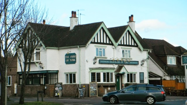
Eleven miles done it was time for some Doom Bar in the Duke of York in Weybourne
The final section was through Rowhill Copse where a substantial path climbs up through the woods following a tiny stream.
A pond in the woods
This is the signboard that marks the start and source of the Blackwater. A few hundred yards later and you come out onto a road and just to the left is a bus stop where Bus No 4 will take you into Farnham where there is a station on the Alton to Woking line.


No comments:
Post a Comment