Snowdon Range

Snowdon Range
Snowdon Range from Moelwyn Mawr

Tuesday, 21 April 2015

NORTH WALES COAST PATH

CHESTER TO THE MENAI BRIDGE

DAY SEVEN - LLANFAIRFECHAN TO THE MENAI BRIDGE

The walking up to now had been good and very interesting but not typical of what I have found on the rest of the bits of the Welsh coast that I have walked. Today was going to be different and more typical. We took one car to near the Menai Bridge and then all went in the other to Llanfairfechan to continue from where we left off.

 The sea front car park at Llanfairfechan on a very cold and blustery morning. The hills all along the back of the coastline had all received a coating of snow and on the coast it was only just above freezing with a wind chill so we all rushed to wrap up.
The sea front at the view across the Lavan Sands to Anglesey.

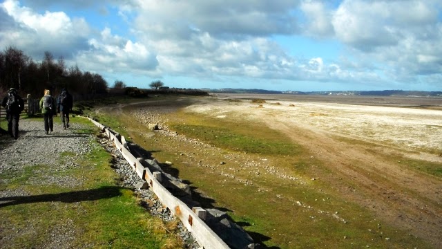
A view around the bay of the first section of wild coastal path.

It goes around this bird reserve on a flood embankment

Walking around to Aber Point scene of the former crossings of the Lavan Sands

 The path continued protected by the sea defences. We stopped for a coffee hidden behind the remains of a stone wall out of the wind coming across the bay.

 Inland we could still see the snow on the hills at the back
The Afon Aber just before it meets the sea. http://en.wikipedia.org/wiki/Afon_Aber
The wild coastline continues from Aber Point first on this vehicular track,

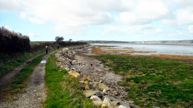
and then on this grassy shoreline.

A view across to Beaumaris on Anglesey.

The coast path has to go inland to get around the estate in which Penrhyn Castle is located and a creek at the outfall of the Afon Ogwen that runs through it. Afon = river.
Aerial views of the castle = https://www.youtube.com/watch?v=IpuYtrshw_A

The route involves going inland to the village of Tal-y-bont, this picture was taken as we followed the coast railway into the village.

The Afon Ogwen which rises in Snowdonia where it goes under the road to enter Penrhyn Park.
A little further on we found a sheltered spot on a roadside wall to have a picnic. After that we crossed the A5 ands went down a lane to the Afon Cegin.

The Cegin valley was heavily industrialised in the 18th and 19th centuries with two separate railway lines conveying slate from quarries in the hills down to Porth Penrhyn to be shipped out to destinations across the world. This is one of them now a cycleway which the North Wales Coast Path uses following closely the pretty river.

The cycleway comes down to here - Port Penrhyn. It was formerly of great importance as the main port for the export of slate from the Penrhyn Quarry, the largest slate quarry in the world at the end of the nineteenth century. It was built, and later expanded, by the Pennant (later Douglas-Pennant) family of the nearby Penrhyn Castle.

View of the port jetty from the west side of the bay at Bangor and some of the headlands as far as Llandudno.

Another view this time from the green at Garth (part of Bangor).
 

It is at Garth that you will find this Pier. Garth Pier is a Grade II listed structure in Bangor, Gwynedd,  North Wales. At 1,500 feet (460 m) in length, it is the second-longest pier in Wales, and the ninth longest in the British Isles. http://en.wikipedia.org/wiki/Garth_Pier

Another view further west as we work our way long the Menai Straits with Anglesey on the other side.

These are Ashley Jones Fields named after a local solicitor who left a bequest for their purchase by the local council  During the (Bangor) Eisteddfod in 1931 a stone circle and table were erected as part of the celebrations. Here the route splits - a high tide route follows the left upper side of the fields and a low tide route goes through the stone circle to the bottom right.

Both routes end up at the beach to he right of this white house, the low tide route is along the beach below the woods.

After an undulating section along a wooded coast, and a climb passing Bangor City Football Ground and a walk along part of the A5 we got there - the Menai Bridge.

Pleased with this photo as it shows this engineering wonder off well.
 
All five us completed the mission walking 87.9 miles - not a drop of rain or any incidents it could not have gone better. Thanks to Bob, Dave Jim and Tracey for accepting the challenge and their company.
 
The next blog will be of the walk across Yorkshire from Kirkby Stephen to Robin Hood's Bay.

Sunday, 19 April 2015

NORTH WALES COAST PATH

CHESTER TO THE MENAI BRIDGE

DAY SIX - DEGANWY TO LLANFAIRFECHAN

 
We took one car to Llandudno Junction Railway Station and then caught a taxi to Deganwy to where we had left off the previous day.
At the level crossing by the station we went to the south west of the railway to carry on along a path to Deganwy Quay Marina which we passed on the landward side keeping next to the railway.
A view downstream towards the marina

A view upstream to Conwy and its castle
Drone aerial views of the Castle https://www.youtube.com/watch?v=xE64gXp_Y2g

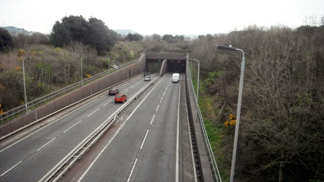
The route passes close to the northern end of the tunnel that takes the A55 under the river but you would not notice it as it is hidden in vegetation and the view across to Conwy holds your attention.

The coast path uses the A647 bridge over the river with the castle drawing you on.

Conwy Harbour front.

The Castle from right underneath by the river.

A typical street inside the walls of the fortified town of Conwy which is the best preserved fortified medieval town in Britain. Unfortunately we di not have the time to do it justice.

Tracey just outside the walls admired the smallest house in Wales and an occupant dressed in Welsh costume. http://thesmallesthouseingreatbritain.co.uk/

After passing through a gate in the walls the coast path follows a shoreline path around Bodlondeb Woods Nature Reserve and passed a school on to Morfa Drive. http://www.conwy.gov.uk/section.asp?cat=11490&Language=1
 

The road took us to a road bridge over the southern tunnel entrance of the A55.
 

The route then goes into a marina where we stopped for a coffee break.

The path then follows the coast around the large Conwy golf course with plenty of soft sand dunes. http://www.conwygolfclub.com/

Then there is a new cycleway which takes the coast path towards the headland.

View back from Penmaen-bach Point towards the Great Orme.

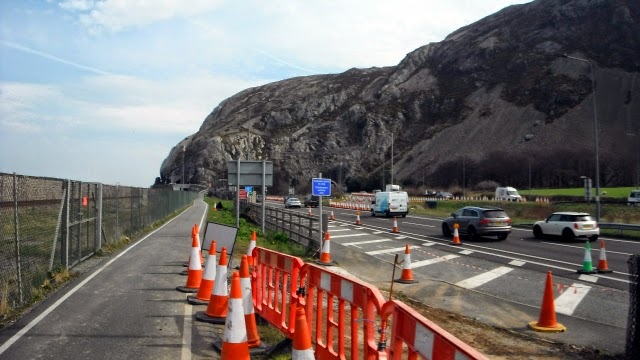
The cycleway route has been cut into the cliffs and deeper into the mountain the road and the railway have tunnels. See the tale of Violet's Leap - http://historypoints.org/index.php?page=site-of-violet-s-leap-penmaenbach

The cycleway exits next to the main road which is followed south west towards Penmaenmawr.

Horse or Mares Tail, Equisetum Arvense was bursting out along the edge of the cycleway which are going to cause a problem!

Eventually we were able to get away from the noise of the road as the path descended to the shoreline and the building ahead was the café where we had lunch. The town of Penmaenmawr was the other side of the road and the railway. http://en.wikipedia.org/wiki/Penmaenmawr

Getting the cycleway around the next headland of Penmaen Mawr was quite an engineering feat involving metal walkways, a path (picture below) cut out of the hillside high above the northbound carriageway.


Then this ramp across to the outskirts of Llanfairfechan. 
A  video tour of the town = https://www.youtube.com/watch?v=Hyu3N29acnQ
 
 The route goes into town and then to the station from where we got the train back along the coast to the car at Llandudno Junction and back to the Premier I.10.9 miles walking.
 

NORTH WALES COAST PATH

CHESTER TO THE MENAI BRIDGE

DAY FIVE - RHOS-ON-SEA TO DEGANWY

 
An advert for this coastline - https://www.youtube.com/watch?v=uvfaahhaXus
 
We stayed at the Premier Inn at Llandudno Junction for four nights which has a Brewers Fayre next to it for breakfast and dinner. We got the No 24 Bus at 9:26 outside near the Black Cat Roundabout which brought us back to Rhos-on-Sea for 9:42. Another glorious day in prospect.
 
The white building is the Cayley Arms in Rhos-on-Sea where the bus stop is located.

The beach looking towards Colwyn Bay

The harbour at Rhos-on-Sea when the tide is out.

 As we rounded the first headland we went into St Trillo's reputed to be the smallest church in Wales and built in the 16th Century - just 12 feet by 6 feet
Picture of the exterior

As we followed the promenade Penrhyn Bay came into view with the Little Orme at the end.

Penrhyn Bay

The Little Orme brought a stiff climb to the top and grassy paths

It was from this point that we had our morning coffee stop the finest of views.
 
Tracey spotted a seal in the water and from a  little further along the cliff we could look down on them on the beach.
 

Traversing along the north side of the Little Orme the North Wales Coast Path provides good views.

The path leads to the road down into Llandudno and a gradual descent to the coast.

Once on the promenade it was a 30 minute walk to the town centre at the other end of the bay.

The big white building at the end is the Grand Hotel and the route goes behind it on to the Great Orme.

Before tackling the Great Orme we had lunch in the former Palladium Cinema now a very interesting Wetherspoons pub - http://cinematreasures.org/theaters/22974

After going around the back of the Grand Hotel you get this good view of Llandudno Pier. The weather was just perfect for enjoying such a facility. http://www.llandudnopier.com/

The coast path follows a toll road right around the Great Orme a limestone headland sticking out in to the Irish Sea. Four miles of good views. https://www.youtube.com/watch?v=jdLTKUb0w8g

 View back towards the pier.

The entire route is along a footway adjacent to the road with the benefit of views down the cliffs to the sea


A group of the Great Orme Kashmiri Goats http://www.llandudno.com/goats.html

A wee china chappy sleeping in the Rest and Be Thankful Café near the lighthouse at the end of the promontory. http://www.restandbethankful.net/

The descent along the south west side


The route comes down to Llandudno West and the bay containing the Conwy Sands.
Having walked along the promenade the coast path is along the side of sand dunes to Deganwy from where we got Bus No 13 back to the Black Cat Roundabout after 12.7 miles of walking.
The history of Deganwy and the castle that used to be on the couple of rocky hills above it is dealt with in this video https://www.youtube.com/watch?v=BVDeH5HeYAU