CHESTER TO THE MENAI BRIDGE
DAY FOUR - RHYL TO RHOS-0N-SEA


It was early morning so there were few people around, the seafront was empty and the beach vast as the tide was out.

The route is along the seafront until the mouth of the River Clwyd which is crossed by this extraordinary lifting pedestrian / cycleway bridge in Rhyl harbour. http://en.wikipedia.org/wiki/River_Clwyd

Before you get to the bridge the last part of the Rhyl promenade is being rebuilt along with the sea defences and this is the view back at the works in progress.

After rounding sand dunes at the mouth of the creek the route joins this tarmac cycle path along Kinmel Bay with a shingle beach and sand dunes and caravans inland.
Video of a flight along the coastline - https://www.youtube.com/watch?v=6J03jCgeFC8

Sometimes there were vast caravan parks inland.

These varieties of sea walls continued to Pensarn

There were some gaps in the urban area and fields on the left sandwiched between the coast railway and the sea. We stopped at the Pantri Beach Café for lunch.

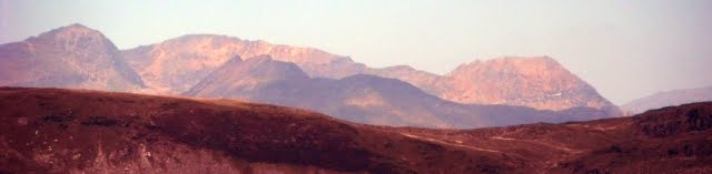
We could see Grwych Castle inland on the edges of the hills that were no coming into view.
Aerial Views of the castle and now a ruin = https://www.youtube.com/watch?v=CoKjQD0qzAc
This rough ground just beyond Abergele next to the sea made a pleasant change.

The pebble beach continues with the newly surfaced cycleway.

Groynes and banks of stones protect the coast line.

This is the stream that comes to the sea at Llanddulas.
It was here that there was a notable railway crash in 1868 = https://denbighshirearchives.wordpress.com/2011/10/06/the-abergele-train-disaster-august-20th-1868/

The next section of cycleway was built between two massive coastal protection schemes the thousands of concrete shapes on the sea side were definitely not for climbing over.

A view back along this section as we rounded a headland to enter Colwyn Bay

Back to the traditional seaside promenade for two miles as we headed towards Colwyn Pier.
Aerial video of pier = https://www.youtube.com/watch?v=vxOdKBwTEoY

Lying derelict and boarded up the pier was not a pretty sight. http://www.piers.org.uk/pierpages/NPScolwyn.html
It was just another mile of seafront to Rhos-on-Sea and the Cayley Arms after 12.4 miles from where we were able to get the Number 12 bus back to Rhyl bus station which left us with another mile to walk to the car.
No comments:
Post a Comment