CHESTER TO THE MENAI BRIDGE
DAY SIX - DEGANWY TO LLANFAIRFECHAN
We took one car to Llandudno Junction Railway Station and then caught a taxi to Deganwy to where we had left off the previous day.
At the level crossing by the station we went to the south west of the railway to carry on along a path to Deganwy Quay Marina which we passed on the landward side keeping next to the railway.
A view downstream towards the marina
A view upstream to Conwy and its castle
Drone aerial views of the Castle https://www.youtube.com/watch?v=xE64gXp_Y2g
The route passes close to the northern end of the tunnel that takes the A55 under the river but you would not notice it as it is hidden in vegetation and the view across to Conwy holds your attention.
The coast path uses the A647 bridge over the river with the castle drawing you on.
Conwy Harbour front.
The Castle from right underneath by the river.
A typical street inside the walls of the fortified town of Conwy which is the best preserved fortified medieval town in Britain. Unfortunately we di not have the time to do it justice.
Tracey just outside the walls admired the smallest house in Wales and an occupant dressed in Welsh costume. http://thesmallesthouseingreatbritain.co.uk/
After passing through a gate in the walls the coast path follows a shoreline path around Bodlondeb Woods Nature Reserve and passed a school on to Morfa Drive. http://www.conwy.gov.uk/section.asp?cat=11490&Language=1
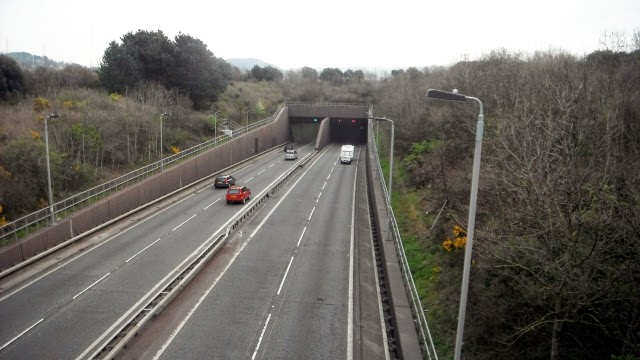
The road took us to a road bridge over the southern tunnel entrance of the A55.
The route then goes into a marina where we stopped for a coffee break.
The path then follows the coast around the large Conwy golf course with plenty of soft sand dunes. http://www.conwygolfclub.com/
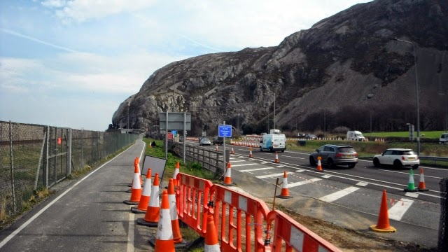
Then there is a new cycleway which takes the coast path towards the headland.
View back from Penmaen-bach Point towards the Great Orme.
The cycleway route has been cut into the cliffs and deeper into the mountain the road and the railway have tunnels. See the tale of Violet's Leap - http://historypoints.org/index.php?page=site-of-violet-s-leap-penmaenbach
The cycleway exits next to the main road which is followed south west towards Penmaenmawr.
Horse or Mares Tail, Equisetum Arvense was bursting out along the edge of the cycleway which are going to cause a problem!
Eventually we were able to get away from the noise of the road as the path descended to the shoreline and the building ahead was the café where we had lunch. The town of Penmaenmawr was the other side of the road and the railway. http://en.wikipedia.org/wiki/Penmaenmawr
Getting the cycleway around the next headland of Penmaen Mawr was quite an engineering feat involving metal walkways, a path (picture below) cut out of the hillside high above the northbound carriageway.
Then this ramp across to the outskirts of Llanfairfechan.
A video tour of the town = https://www.youtube.com/watch?v=Hyu3N29acnQ
The route goes into town and then to the station from where we got the train back along the coast to the car at Llandudno Junction and back to the Premier I.10.9 miles walking.


No comments:
Post a Comment