Snowdon Range

Snowdon Range
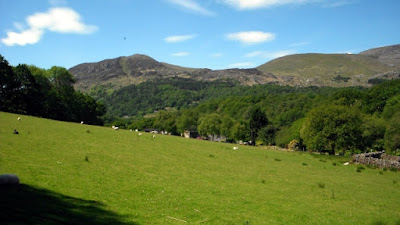
Snowdon Range from Moelwyn Mawr

Sunday, 28 June 2015

THE TALLY SO FAR

LONG DISTANCE PATHS COMPLETED AS AT 9 APRIL 2017

1066 Country Walk (East Sussex)
Allan Kings Way (Hampshire)
Angles Way and Angles Way Link (Norfolk / Suffolk)
Avon Valley Path (Hampshire and Wiltshire)
Balcon de Cote D'Azur (France)
Beacons Way (Wales)
Blackwater Valley Path (Hampshire)
Brenda Parker Way (Hampshire)
Castleman Trail (Hampshire / Dorset)
Chemin du Mont St Michel from Cherbourg (Normandy)
Clarendon Way Wiltshire /Hampshire)
Cleveland Way (Yorkshire)
Coast to Coast Walk (Wainwrights Route) (Cumbria and Yorkshire)
Coleridge Way (Somerset and Devon)
Collines et Villages de Paris (France)
Cotswold Way (Worcestershire, Gloucestershire and Bath)
Cumbria Way (Cumbria)
Dales Way (Cumbria and West and North Yorkshire)
Dartmoor Way (Devon)
Derwent Way (East Yorkshire)
Dorset Coast Path (Dorset)
Dorset Jubilee Trail (Dorset)
East Mendip Way (Somerset)
Elham Valley Way (Kent)
Fish River Canyon (Namibia)
Four Stations Walk - Godalming to Haslemere (Surrey)
Fox Way (Surrey)
Great Glen Way (Scotland)
Greensand Way (Surrey and Kent)
Guernsey Coast Path (Channel Islands)
Hadrian's Wall Path (Cumbria, Northumberland and Tyne and Wear)
Hangers Way (Hampshire)
High Weald Landscape Trail (Kent and East and West Sussex)
Isle of Wight Coast Path (Isle of Wight)
Itchen Way (Hampshire)
Jersey Coast Path (Channel Islands)
Kelvin Walkway (Scotland)
Kerry Way (Eire)
Lambourn Valley Way (Oxfordshire and Berkshire)
Limestone Link (Somerset and Gloucestershire)
Lyke Wake Walk (North Yorkshire)
Medway Valley Walk (Kent)
Minster Way (East and North Yorkshire)
Monarch's Way Book 3 (Dorset. Wiltshire, Hampshire and East and West Sussex)
Nar Valley Way (Norfolk)
North Downs Way (Surrey and Kent)
North Norfolk Coast Path (Norfolk)
Offa's Dyke Path (England / Wales)
Outer London Orbital Loop (Greater London, Buckinghamshire, Essex, Hertfordshire and Surrey)
Oxfordshire Way (Oxfordshire)
Peddars Way (Norfolk and Somerset)
Ridgeway (Buckinghamshire, Oxfordshire, Berkshire and Wiltshire)
River Anton Way (Hampshire)
River Parrett Trail (Dorset and Somerset)
Robert Louis Stephenson Trail (France)
Sandstone Trail (Cheshire)
Sentiers de la Seine Paris (France)
Shakespeare's Way (London, Buckinghamshire, Oxfordshire, Warwickshire)
Solent Way (Hampshire)
South Downs Way (Hampshire and East and West Sussex)
South West Coast Path - Poole to Exmouth (Dorset and Devon)
Test Way (Hampshire, Berkshire and Wiltshire)
Thames Path (Greater London, Buckinghamshire, Gloucestershire, Surrey, and Wiltshire)
Three Castles Walk (Berkshire and Hampshire)
Three Peaks Walk (Yorkshire)
Via Francigena (England / France / Switzerland / Italy / Vatican)
Waters of the Gap - Cirencester to Bath (Gloucestershire and Somerset)
Wayfarer's Walk (Hampshire and Berkshire)
Weald Way (East Sussex and Kent)
Wessex Ridgeway (Devon, Dorset and Wiltshire)
West Highland Way (Scotland)
West Mendip Way (Somerset)
West Sussex Literary Trail (Surrey and West Sussex
White Horse Trail (Wiltshire)
Wicklow Way (Eire)
Worcestershire Way (Worcestershire)
Wye Valley Path (Wales)
Wysis Way (Monmouthshire and Gloucestershire)

Sunday, 21 June 2015

NOT THE CAMBRIAN WAY - JUNE 2015 - WALK FIVE

TANYGRISIAU TO CROESOR - 8.1 MILES

There was still much doubt in the camp this morning about being able to complete the northern end of Cambrian Way because of the size of the mountains ahead. So we settle for exploring the area between these two settlements whist omitting the two highest peaks but still doing a similar mileage. We left one car in the car park at Croesor and went in the other to the car park in Tanygrisiau.
Following the road from the car park passing the railway station and going under the line we then took a footpath on the right which steadily climbs to the Llyn Stwlan Reservoir. This is the view back looking towards to the Tanygrisiau Reservoir. http://www.fhc.co.uk/ffestiniog.htm

Again looking back again from a point higher up.

This is the view upwards from a coffee break with the walls of the Llyn Stwlan Dam in the background. We climbed up to the left of it and began a clockwise circuit around it.

Llyn Stwlan

The path that contours gradually up around the Llyn below Craigysgafo.

Llyn Stwlan from the west.

Llyn Stwlan from the north west.  The route goes over a pass to the north east of Moelwyn Mawr.

From this pass you can see the Snowdon Ridge in the background. The main peak is on the left.

The same view without using the telephoto lens.

The path passes to the east of these quarry pits. That is Moelwyn Mawr in the background.

The ruins of Rhosydd Quarry. https://en.wikipedia.org/wiki/Rhosydd_Quarry

The descent from the Rhosydd Quarry to the Cwmorthin Quarry. https://en.wikipedia.org/wiki/Cwmorthin_Quarry

Looking back at the Cwmorthin Quarry from the north west.

We followed the path on the map to Llynnau Diffwys but there is scant evidence of it on the ground.

We continued again not finding much evidence of a path to the Llyn Cwm-y-foel. This is the view from the dam at the southern end.

From here a scenic path goes diagonally down the west side of Cwm Croesor until you reach the village at the far end. Above to the right is the ridge going to Cnicht.


Saturday, 20 June 2015

CAMBRIAN WAY - JUNE 2015 - WALK FOUR

CROESOR TO BETHANIA 7.1 MILES

It was agreed that we had not yet recovered enough to tackle the mountains that lie between Tanygrisiau and Croesor so we did the next section instead. Not only did it turn out to be a beautiful day but a stunning walk. We parked one car in the layby on the A498 at Bethania where there is a toilet (it is a pay and display car park) which is used by those climbing Snowdon on the Watkin Path (GR 626506) and the other in the car park at Croesor (GR 621447). https://en.wikipedia.org/wiki/Croesor
Cnicht at 2265 feet or 690 metres is the reason why most walkers come to Croesor and its triangular shape from the south west certainly looks a challenge although it can be approached along a ridge from the other side. Today we just paused to look at it as we crossed a moor going north west out of the village. https://en.wikipedia.org/wiki/Cnicht

 We followed an old unsurfaced road that led down to the Afon Dylif.

The undulating moorland was very attractive. This was a photo looking back.

This is the view in the other direction.
 
Snowdon was to the north.

 Just as we left the Access Land at Bwichgwernog we paused for coffee and biscuits.

It was then a mile down a very narrow and pleasant road to Nantmor a small attractive village in the valley of Afon Glaslyn. Every bend in the road brought a different view. This was one view south west towards Moel-ddu the mountain in the background.

This is Nantmor Station on the Welsh Highland Railway. We had lunch on a seat in the station but all was quiet, there were no trains due for at least an hour when we left. https://en.wikipedia.org/?title=Welsh_Highland_Railway Everything was extremely well maintained.

We then joined the path that runs up the east side of the Afon Glaslyn through the Aberglaslyn Gorge. The first half a mile was rocky and required some care but then it levelled out and led to Beddgelert after 1.3 miles.


Video of canoeing the Gorge = https://www.youtube.com/watch?v=CjKc9t0J2XI

A Welsh Dragon outside a shop in Beddgelert
Video - A visitor guide to Beddgelert https://www.youtube.com/watch?v=vIBk4DI2_Ig

After a visit to a café in Beddgelert we continued to follow the east side of the Afon Glaslyn first along a minor road and then along this lovely path.


After 1.5 miles we reached Llyn Dinas and followed a lovely path around the south east side of the lake, the A498 running along the north west side.


View from the north east end of the lake at Llyndy Isaf Farm.
 

Thursday, 18 June 2015

CAMBRIAN WAY - JUNE 2015 - WALK THREE

LLYN TRAWSFYNYDD TO TANYGRISIAU 8.1 miles

There was almost a revolt in the camp this morning as yesterday's efforts had taken their toll. After assurances that there were no mountains today my fellow ramblers decided they would continue on the Cambrian Way northwards from where we left off. We left one car in a car park at Tanygrisiau and then left another on the highway verge near the camp site on the south side of Llyn Trawsfynydd.

With another glorious day in prospect we set out north westward around Llyn Trawsfynydd following initially the road. There is a cycle route all around the lake and near where the road comes to an end the public footpath that continues has been converted to a mountain bike trail at great expense. http://www.trawslake.com/activities/cycling

The route climbs steadily and you get a lovely view south east across the lake, there is also a special picnic spot at this point.

It then descends in the direction of the lake passing above the wooded Coed y Rhygen Nature Reserve.

Trawsfynydd was the first inland civil Magnox nuclear station and drew its cooling water from Llyn Trawsfynydd which has been created through a large dam. It started service in 1965 and generated 69 TWh of electricity over the 26 years until its closure in 1991. http://www.magnoxsites.co.uk/site/trawsfynydd/
 
This is the view up the lake taken from the dam which the route crosses.

This is the view down from the dam along the gorge below. After a short section along the north shore of the lake the Cambrian Way takes a footpath through Coed Caersaeson wood and then a few fields before joining minor roads for the descent to the village of Maentwrog. https://en.wikipedia.org/wiki/Maentwrog

It is very unusual to find a pub on the Cambrian Way and even more so one that crops up at lunch time. Four happy ramblers enjoyed an excellent lunch http://www.grapeshotelsnowdonia.co.uk/


There are two bridges over the Afon Dwyryd at the junction of the A496 and the A487. This is the old one which is single file for motorists. From here the route takes a minor road along the north side of the Afon Dwyryd and then takes a path that climbs through the Coedydd Maentwrog National Nature Reserve.
 

This is Dduallt Farm House which has an interesting history and is located just before you reach the Ffestiniog Railway. http://datingoldwelshhouses.co.uk/library/Hhistory/HHDduallt.pdf

There is a pedestrian crossing of the line and this is the view above it back down the valley to Maentwrog.

This leads to Dduallt Station which is a request stop and also a great spot for taking pictures of the trains because the station is in the middle of a complete spiral loop of the line. This train was descending from Ffestiniog as we got there.  https://en.wikipedia.org/wiki/Dduallt_railway_station

A path crosses the railway onto the platform and then leaves at the other end. Video of the loop and the station = https://www.youtube.com/watch?v=SA4rZX7pPbc

Leaving the northern end of the station you follow a path which keeps close to the railway in the direction of Ffestiniog.

On the right of this picture is the remains of a dismantled branch off the line. The track is the Cambrian Way and the active line is above to the left.

The active line goes into a tunnel and gradually the path climbs above it. This is the view looking back.

And then the path descends to where the railway becomes visible and you reach the Tanygrisiau Reservoir where there is another power station. https://en.wikipedia.org/wiki/Tanygrisiau 

As we reached the car park this train passed above the village.
This was a beautiful walk and one that can be highly recommended as can getting the train up from Porthmadog and walking back.