LLYN TRAWSFYNYDD TO TANYGRISIAU 8.1 miles
There was almost a revolt in the camp this morning as yesterday's efforts had taken their toll. After assurances that there were no mountains today my fellow ramblers decided they would continue on the Cambrian Way northwards from where we left off. We left one car in a car park at Tanygrisiau and then left another on the highway verge near the camp site on the south side of Llyn Trawsfynydd.
With another glorious day in prospect we set out north westward around Llyn Trawsfynydd following initially the road. There is a cycle route all around the lake and near where the road comes to an end the public footpath that continues has been converted to a mountain bike trail at great expense. http://www.trawslake.com/activities/cycling
The route climbs steadily and you get a lovely view south east across the lake, there is also a special picnic spot at this point.
It then descends in the direction of the lake passing above the wooded Coed y Rhygen Nature Reserve.
Trawsfynydd was the first inland civil Magnox nuclear station and drew its cooling water from Llyn Trawsfynydd which has been created through a large dam. It started service in 1965 and generated 69 TWh of electricity over the 26 years until its closure in 1991. http://www.magnoxsites.co.uk/site/trawsfynydd/
This is the view up the lake taken from the dam which the route crosses.
This is the view down from the dam along the gorge below. After a short section along the north shore of the lake the Cambrian Way takes a footpath through Coed Caersaeson wood and then a few fields before joining minor roads for the descent to the village of Maentwrog. https://en.wikipedia.org/wiki/Maentwrog
It is very unusual to find a pub on the Cambrian Way and even more so one that crops up at lunch time. Four happy ramblers enjoyed an excellent lunch http://www.grapeshotelsnowdonia.co.uk/
There are two bridges over the Afon Dwyryd at the junction of the A496 and the A487. This is the old one which is single file for motorists. From here the route takes a minor road along the north side of the Afon Dwyryd and then takes a path that climbs through the Coedydd Maentwrog National Nature Reserve.
This is Dduallt Farm House which has an interesting history and is located just before you reach the Ffestiniog Railway. http://datingoldwelshhouses.co.uk/library/Hhistory/HHDduallt.pdf
There is a pedestrian crossing of the line and this is the view above it back down the valley to Maentwrog.
This leads to Dduallt Station which is a request stop and also a great spot for taking pictures of the trains because the station is in the middle of a complete spiral loop of the line. This train was descending from Ffestiniog as we got there. https://en.wikipedia.org/wiki/Dduallt_railway_station
A path crosses the railway onto the platform and then leaves at the other end. Video of the loop and the station = https://www.youtube.com/watch?v=SA4rZX7pPbc
Leaving the northern end of the station you follow a path which keeps close to the railway in the direction of Ffestiniog.
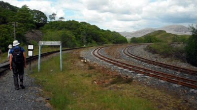
On the right of this picture is the remains of a dismantled branch off the line. The track is the Cambrian Way and the active line is above to the left.
The active line goes into a tunnel and gradually the path climbs above it. This is the view looking back.
And then the path descends to where the railway becomes visible and you reach the Tanygrisiau Reservoir where there is another power station. https://en.wikipedia.org/wiki/Tanygrisiau
As we reached the car park this train passed above the village.
This was a beautiful walk and one that can be highly recommended as can getting the train up from Porthmadog and walking back.


No comments:
Post a Comment