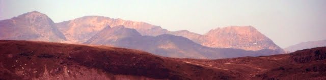
Snowdon Range

Snowdon Range
Snowdon Range from Moelwyn Mawr

Thursday, 26 February 2015

Blackwater Valley Path Stage 2 of 2 - 25 February 2015

BLACKWATER TO ROWHILL COPSE

It has to be said that this 12-mile section was incredibly noisy as it follows main roads and railways and goes under and over a good few as well but it was entertaining and kept Jim and I out of mischief.

 
This is the bridge carrying the A30 over the Blackwater near the railway station.

 
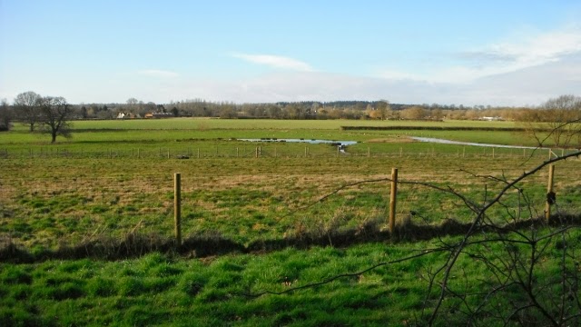
After an initial section near an industrial estate the path is running through fields next to the river but sandwiched between the A331 on the left and the railway on the right which gave the appearance of being more remote that it was.

 
The river was getting smaller with every confluence with an incoming channel including along this section Cove Brook.

 
After nearly 2 miles it is under the M3 and its intersection with the A331.
 
 
Immediately after it is through a well landscaped office and industrial estate

 
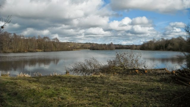
Frimley Lakes a pleasant place to watch the wild fowl.


South of Coleford Bridge the waters were yellow from the pollution from a gravel works.

 
This vehicular track ran for over a mile with the A331 to the left. Signboards highlighted the wildlife that can still be found in this noisy location.
 
At North Camp Station there is the Old Ford Public House which would make a lunch stop after six miles.

 
After that Rushmoor Borough Council have implemented an awful diversion away from the course of the river via road which is a car park and an access to industrial premises and then along this potholed unsightly track, one of the worst diversions I have ever seen.

 
The diverted route returns to the original path and one then gets an idea of the lovely path that has been lost as there is a pretty path by the river where we had a picnic lunch on some logs.

 
After passing under a railway and through Lakeside Park you reach the Basingstoke Canal and cross the river and the A331 using the towpath. The railings are along a section which is a giant tray carrying the canal over these features.

 
As the path wanders through North Town, its housing and industrial estates, it is now clearly narrower.

 
As it continues through Aldershot Park it is now the size of a large ditch.

 
At Pea Bridge the path is next to a tiny stream with a large lake to the right.

 
Peering through the fence along the west side one gets a nice view of the lake but there is no public access to it.
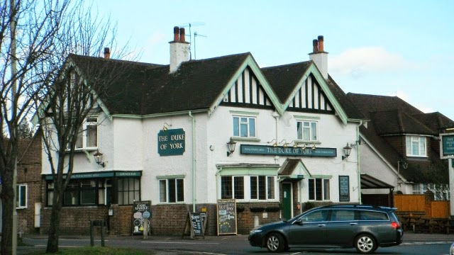
 
Eleven miles done it was time for some Doom Bar in the Duke of York in Weybourne

 
The final section was through Rowhill Copse where a substantial path climbs up through the woods following a tiny stream.


A pond in the woods

 
This is the signboard that marks the start and source of the Blackwater. A few hundred yards later and you come out onto a road and just to the left is a bus stop where Bus No 4 will take you into Farnham where there is a station on the Alton to Woking line.


Wednesday, 18 February 2015

Blackwater Valley Path Stage 1 of 2 - 23 February 2015

SWALLOWFIELD TO BLACKWATER

The Blackwater Valley Path runs from Swallowfield to Rowhill Copse at Heath End and the maps and details of the walk are at http://www.blackwater-valley.org.uk/valley_map.html

Jim and I undertook the first stage of this walk by going to Reading and getting the bus from Station Road Stop SC (just across from the Station) to Swallowfield and then getting the train back from Blackwater to Reading. Buses 72 and 82 go on the outward route.

 
Ask the bus driver to stop at the village hall because that is where the walk begins and this sign is located on a post next to the road. GR 4725 1650 - the Car Park marked on the OS sheets. The symbol is used on the waymarks.

 
The first section is along the road to Salter's Bridge where the River Broadwater is in two channels, this is the first, the second is Salter's Bridge.  The Broadwater runs from the junction of the Whitewater and the Blackwater downstream to the River Loddon and we were walking upstream.

 
After Salter's Bridge there is more road walking and we stopped in a cemetery for a coffee break and this was the view from the back of the cemetery across the valley of the Broadwater.


A quarter of a mile later you leave the road to go down a path to the Broadwater.

 
This is the confluence of the Whitewater on the right and the Blackwater on the left.

 
At Jouldings Farm we encountered this muddy path on one of the sections where we were a little way away from the river bank.

 
This was the four foot deep ford at The New Mill near Lower Common. Fortunately there was a footbridge.

 
This is the Mill taken from the footbridge.

 
A section of the Blackwater just upstream from the Mill.


This is the Tally Ho at Eversley on the route and a place for a lunch stop  http://www.homecountiespubs.co.uk/tallyho/
 
We were a little early and had a picnic on a log watching a kite in the pub garden.

 
Shortly after Fleethill Farm you encounter the first of many gravel extraction areas and the first ones are active as can be seen from the two excavators.

 
The gravel was moved some distance by these conveyor belts and the path crosses a bridge over one of them.

 
The older pits in the Moor Green Lakes Nature Reserve http://www.blackwater-valley.org.uk/moor_green_lakes_.html presented a prettier picture and we had another coffee break with this view.

 
The tower of St Michael and All Angels at Sandhurst, one that has its origins in the 13th century but was remodelled by the Victorians. The sandy coloured stone made a pleasing façade. http://www.stmichaels-sandhurst.org.uk/history.html  


Not what you think - it is full of door and cabinet furniture http://www.knobshop.biz/5.html

 
After walking along roads through Sandhurst and following a path by the side of the railway near the station it is back to the winding river and a pleasant section.


This was an amazingly long footbridge over the river and the railway  to Shepherd Meadows Nature Reserve
 
After crossing the river two more times we arrived at the A30 and the Blackwater Railway Station after 10.3 miles.


Monday, 2 February 2015

CASTLEMAN TRAIL STAGE TWO

Castleman Trail Stage Two

THE CASTLEMAN TRAIL – Stage Two – Stapehill to Hamworthy -  1 February 2015

 
To undertake this as a linear 9.2 mile walk, park at Hamworthy Station (BH16 5AA) and take the train to Bournemouth (19 minutes) and go to Stand 1 in the bus station on the south side and get More Bus No 13 to Uddens Cross which takes 33 minutes.
 
The bus stop is opposite the Old Thatch Restaurant in Stapehill. Go down the side road next to it to get to the Castleman Trail.

The initial section is along the disused railway until you get near to the A31 after which it has been built upon.
 
The route then splits, pedestrians can cross some fields to follow the River Stour.

You pass Canford School on the opposite bank and then get this view of a weir.


After that you cross this beautiful but bouncy suspension bridge.
 
You follow an avenue of trees along an old track away from the school and under this arch with the old railway track above it. On reaching a road you turn left and walk through Oakley.

An hour and half after the start you reach the Willett Arms, open all day for food and a good family orientated place to stop for lunch.

Then you join the former track of the Castleman Railway and this photo is on the first section from Oakley to Broadstone.

This is the section south of Broadstone
 
This looks like a railway track but it is a section of the Roman Road that you follow towards Upton Country Park where the Castleman Trail ends. Pass to the right of the house and then around the back where there is a refreshment kiosk and continue down through the gardens to the shore and turn right.

Follow the shore of Holes Bay and you get this lovely view across to Pergins Island. On reaching the main line railway which crosses the bay turn right and follow it to leave the Park to locate the Hamworthy Station.

All the maps you need can be downloaded and printed from https://www.dorsetforyou.com/castlemantrailway


Monday, 26 January 2015

CASTLEMAN TRAIL STAGE ONE

THE CASTLEMAN TRAIL – Stage One – Stapehill to Ringwood - 19 January 2015

The Castleman Trailway is one of Dorset's gentlest way-marked, walking, cycling and horse riding routes. This 16.5 mile (26.5 kilometres) Trailway follows much of the old Southampton to Dorchester railway line. The Trailway takes you through some of East Dorset's stunning landscape whilst also connecting a string of settlements between Ringwood and Poole. You can find out more about it and the maps at https://www.dorsetforyou.com/castlemantrailway

I have done the first of the two halves with Jim (in photos). We went by car to the Furlong Car Park in the centre of Ringwood and parked there (£5 for 20 hours) then caught the 9:15 am  132 Bus from Stand D in Meeting House Lane which runs along the south side of the car park near Sainsbury's. [This bus no longer runs so you will need to get the No 38 bus to Victoria Road, Ferndown and then cross the road to the bus stop on the other side and get the No 13 bus to Uddens Cross opposite the Old Thatch Restaurant if you want to follow in our footsteps].This took us to Uddens Cross from which it was a flat 9.2 miles back.


The initial forest path takes you to a bridge over the A31 and you stay to the north of it until Ringwood is in sight.


It is easy going along forest tracks through Uddens Plantation


One section is along Uddens Water, then there are views of West Moors Nature Reserve.


After passing through West Moors where it is possible to get sustenance at the Tap & Railway, it is on to the disused railway which heads in a dead straight line to Ashley Heath crossing the Moors River at one point. 
The former Ashley Heath Station


A wild section where the former railway went through a cutting.


After going under the A31 it is on to a section of the old railway which crosses the Avon Valley with a series of restored old railway bridges.


The Parish Church of St Peter and St Paul in Ringwood from the Trail


 Left the Trail to follow the Avon Valley Trail north to end up at the Fish Inn near the A31 (the pub sign on the OS Maps) for lunch at 13:30 then walked through the Churchyard to the car park.